Disclosure : This site contains affiliate links to products. We may receive a commission for purchases made through these links.
New Guinea (Papua New Guinea and Indonesia) ITMB
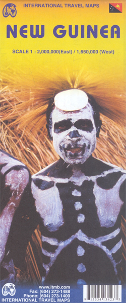
New Guinea Island on a double-sided, indexed map from ITMB covering on one side Papua New Guinea at 1:2,000,000 and on the reverse the Papua Province of Indonesia with the adjoining islands of western Indonesia. On one side is a map of Papua New Guinea at 1:2,000,000 covering the whole of the country except for the small islands east of the Bougainville Island and 186ยฐ. Topography is shown by altitude colouring with names of mountain ranges and peaks, plus graphics for swamps, mangrove and coral reefs in coastal waters. All heights are given in feet. The map shows the country’s road network and indicates airports, plus numerous local airports or landing strips. Also shown are internal administrative boundaries with names of the provinces. Symbols highlight various places of interest including beaches and scuba diving sites. Latitude and longitude lines are drawn at intervals of 1ยฐ. The index includes a separate list of islands.On the reverse is a map of the western half of New Guinea island, the Indonesian province of Papua, plus the nearby islands of Arafura, Timor, Ceram, Banda and Halmahera seas, including Seram/Ceram, Waigeo, Ampat Islands, Kai Islands, Aru Islands, Tanimbar Islands, etc. Presentation of the topography is as for PNG, with national parks also marked and more places of interest including temples and historical sites. Also marked are ferry routes between the islands.

Related Products:
 Papua New Guinea – Indonesian Papua & Maluku Islands Reise Know-How
 Papua & Maluku Islands Nelles
 Papua New Guinea Hema
 ADMIRALTY Total Tide Area 7 – Australia, Indonesia & Papua New Guinea – 12 Months
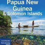 Lonely Planet Papua New Guinea and Solomon Islands
 Papua New Guinea
 Flag of Papua New Guinea
 NP35 Indonesia Pilot Vol 3 2021
 Admiralty Chart PNG642 – Papua New Guinea, North East Coast, Lae
 NGA Chart 82015 – Solomon Islands [Papua New Guinea and Solomon Islands]
 Admiralty Chart PNG643 – Papua New Guinea, North East Coast, Approaches to Lae
 Admiralty Chart PNG622 – Papua New Guinea, South Coast, Port Moresby
 Inside the Crocodile: The Papua New Guinea Journals
 Admiralty Chart PNG646 – Papua New Guinea, North Coast, Approaches to Madang
 Indonesia Periplus Travel Map
 Admiralty Chart PNG519 – Papua New Guinea, North East Coast, Ward Hunt Strait to Star Reefs Passage
 Bahamas ITMB
 Africa Western ITMB
 Madagascar ITMB
 Japan South ITMB Railway & Road Map
 Nigeria & Niger ITMB
 Fiji & Tonga ITMB
 Bahrain and Manama City ITMB
 Dominica & Saint Lucia ITMB
 Cape Verde & West Africa ITMB
 USA Western Railroads/Highways ITMB
 Pakistan ITMB
 New Zealand ITMB
 Morocco ITMB
 Thailand ITMB
 Panama ITMB
 Istanbul & Northwest Turkey ITMB
 Algeria ITMB
 Seattle & Northwest USA ITMB
 Romania & Moldova ITMB
 Peru ITMB
 India North and West ITMB
 Saudi Arabia & Kuwait ITMB
 Bolivia ITMB