Disclosure : This site contains affiliate links to products. We may receive a commission for purchases made through these links.
New England Easy-to-Read Rand McNally

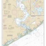
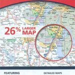
New England Easy-to-Read map at 1:560,000 approx. in a series of regional maps of United States from Rand McNally, with Maine on one side and Massachusetts, Connecticut, Rhode Island, Vermont and New Hampshire on the other. For clarity of road information, the road network is presented on a plain background with names and heights of peaks indicating the topography. National/state parks and other protected areas are highlighted. Road network indicates toll highways and includes unsurfaced local roads. Driving distances are marked on many local routes and scenic roads are highlighted. Symbols indicate various places of interest, including campsites. The map has no geographical coordinates. Each state has a separate index which lists locations with their population figure.Enlargements show in greater detail the vicinity of: in Connecticut Hartford, Bridgeport and New Haven; in Maine Portland, Lewiston and Bangor; in New Hampshire Concord, Manchester and Nashua; in Rhode Island Newport and Providence; in Vermont Montpelier and Burlington; and in Massachusetts Boston with a plan of the downtown area, Worcester and Springfield. Also provided is a mileage chart, plus information on toll roads, etc.To see other titles in this series please click on the series link.+

Related Products:
 New England Easy to Fold Rand McNally
 Connecticut – Rhode Island Easy-to-Read Rand McNally
 New Hampshire – Vermont Easy-to-Read Rand McNally
 Connecticut & Rhode Island Easy to Fold Rand McNally
 Massachusetts Easy-to-Read Rand McNally
 New England Quickmap
 New Hampshire & Vermont Easy to Fold Rand McNally
 Maine Easy-to-Read Rand McNally
 New Jersey Easy-to-Read Rand McNally
 New York State Easy-to-Read Rand McNally
Arizona Easy-to-Read Rand McNally
New York State Easy-to-Read Rand McNally
Arizona Easy-to-Read Rand McNally
 Pennsylvania Easy-to-Read Rand McNally
 Missouri Easy-to-Read Rand McNally
Tennessee Easy-to-Read Rand McNally
Missouri Easy-to-Read Rand McNally
Tennessee Easy-to-Read Rand McNally
 Illinois Easy-to-Read Rand McNally
 Delaware & Maryland Easy-to-Read Rand McNally
 New England Reise Know-How
 South Carolina Easy-to-Read Rand McNally
 Michigan Easy-to-Read Rand McNally
 Oregon Easy-to-Read Rand McNally
 Louisiana Easy-to-Read Rand McNally
 Georgia Easy-to-Read Rand McNally
 Kansas Easy-to-Read Rand McNally
 Greater Boston – Eastern Massachusetts Regional Rand McNally
 Minnesota Easy-to-Read Rand McNally
 Texas Easy-to-Read Rand McNally
 Mississippi Easy-to-Read Rand McNally
 Wisconsin Easy-to-Read Rand McNally
 California Easy-to-Read Rand McNally
 Washington State Easy-to-Read Rand McNally
Colorado Easy-to-Read Rand McNally
Washington State Easy-to-Read Rand McNally
Colorado Easy-to-Read Rand McNally
 Lonely Planet New England`s Best Trips
North Carolina Easy-to-Read Rand McNally
Lonely Planet New England`s Best Trips
North Carolina Easy-to-Read Rand McNally
 Nebraska Easy-to-Read Rand McNally
 Utah Easy-to-Read Rand McNally
Florida Easy-to-Read Rand McNally
Utah Easy-to-Read Rand McNally
Florida Easy-to-Read Rand McNally
 Iowa Easy-to-Read Rand McNally
 Hawaii Easy-to-Read Rand McNally
 Virginia Easy-to-Read Rand McNally