Disclosure : This site contains affiliate links to products. We may receive a commission for purchases made through these links.
New England Easy to Fold Rand McNally

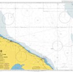
New England at 1:1,750,000 in Rand McNally’s Easy-to-Fold, waterproof and tear-resistant version as part of their series of regional road maps of United States. On one side is a map of the New England states including Maine and extending south to New York City. The map shows the region’s road network on a plain white base which highlights national parks and forest, and indicates which locations are shown on the reverse in greater detail. Accompanying index is arranged by state.On the reverse enlargements show in Connecticut Bridgeport, Hartford and New Haven; in Massachusetts Boston and vicinity, downtown Boston and Worcester; in Maine Portland; in New Hampshire Manchester; in Rhode Island Providence; and in Vermont Burlington; plus the environs of New York City.

Related Products:
 New England Easy-to-Read Rand McNally
 Connecticut – Rhode Island Easy-to-Read Rand McNally
 Maine Easy to Fold Rand McNally
 Connecticut & Rhode Island Easy to Fold Rand McNally
 New Hampshire & Vermont Easy to Fold Rand McNally
 Eastern United States Easy-to-Read Rand McNally
 New York Easy to Fold Rand McNally
 New York State & New England Recreation Map ITMB
 Fodor`s New England: with the Best Fall Foliage Drives & Scenic Road Trips
 New Hampshire – Vermont Easy-to-Read Rand McNally
 New England Quickmap
Central United States Rand McNally
New England Quickmap
Central United States Rand McNally
 California Southern Easy to Fold Rand McNally
 Moon Road Trip USA: New England – Boston, Acadia National Park, White Mountains, Berkshires, Newport, and Cape Cod
 Kansas & Nebraska Easy to Fold Rand McNally
 Washington Easy to Fold Rand McNally
 New York City & Long Island Regional Rand McNally
 Minnesota Easy to Fold Rand McNally
 Alaska Easy to Fold Rand McNally
 Colorado Easy to Fold Rand McNally
 Louisiana Easy to Fold Rand McNally
 New Jersey Easy to Fold Rand McNally
 Georgia Easy to Fold Rand McNally
 Pennsylvania Easy to Fold Rand McNally
 Wisconsin Easy to Fold Rand McNally
 Oregon Easy to Fold Rand McNally
 Virginia Easy to Fold Rand McNally
 New Mexico Easy to Fold Rand McNally
 Tennessee Easy to Fold Rand McNally
 Idaho Easy to Fold Rand McNally
 Iowa Easy to Fold Rand McNally
 Texas Easy to Fold Rand McNally
 Mississippi Easy to Fold Rand McNally
 Arkansas Easy to Fold Rand McNally
 Oklahoma Easy to Fold Rand McNally
 Michigan Easy to Fold Rand McNally
 Illinois Easy to Fold Rand McNally
 Indiana Easy to Fold Rand McNally
 Arizona Easy to Fold Rand McNally
 Massachusetts Easy to Fold Rand McNally