Disclosure : This site contains affiliate links to products. We may receive a commission for purchases made through these links.
Categories
-
Best Sellers
-

Bad Gastein K+F Outdoor Map 16
Bad Gastein area of the Tyrol at 1:35,000 on a GPS compatible, double-sided map from Kรผmmerly+Frey printed on sturdy, waterproof and tear-resistant synthetic paper; contoured, with Read More » -

Edinburgh & The Border Country
Edinburgh is one of Europe`s most elegant and cosmopolitan cities, the Old Town rebuilt on the medieval street plan after being burned down by the English Read More » -

South East Asia ITMB
South-East Asia, including the whole of Indonesia and the Philippines, at 1:4,000,000 on an indexed, double-sided map from ITMB with street plans of central Manila and Read More » -

Bastogne Mini-Ardenne
Ardennes Recreational Maps at a scale of 1:25,000 enable you to discover the Ardennes from junction to junction, each associated with a locality, through a network Read More » -

Baby`s Very First Bus Book
Shaped like a bus, this chunky board book has working wheels and delightful illustrations showing Elephant, Monkey, Mouse, Panda and Baby Bear waiting for the bus, Read More » -

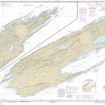
NOAA Chart 14976 – Isle Royale
NOAA maintains the nautical charts and publications for U.S. coasts and the Great Lakes. Over a thousand charts cover 95,000 miles of shoreline and 3.4 million Read More » -

Allerton 1905
Allerton in 1905 in a fascinating series of reproductions of old Ordnance Survey plans in the Alan Godfrey Editions, ideal for anyone interested in the history Read More » -

England, Our England
An anthology and miscellany of everything an Englishman should know: – From Austen to Wordsworth – Jerusalem to the Scout`s Honour – Kings and Queens of Read More » -

Covent Garden – Its Romance and History
`Covent Garden` is a historical and topographical account of one of the most interesting spots in the metropolis. Reginald Jacobs charts the history of the area, Read More » -

Oman and United Arab Emirates Wall Map
Oman and United Arab Emirates Wall Map at 1:1,250,000 from Gizi Map, size 74 x 94cm (29″ x 37″ approx), with excellent presentation of the topography, Read More »
-


