Disclosure : This site contains affiliate links to products. We may receive a commission for purchases made through these links.
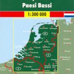
Netherlands Hallwag Road Map
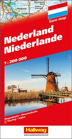
Double-sided and detailed touring map of the Netherlands showing seven different kind of roads, with road names and junction numbers, intermediate driving distances in km, petrol stations, restaurants, parkings and motels along main roads.Tourist routes, railways, airports, administrative boundaries and restricted areas are also marked alongside national parks, natural curiosities, woods and heath lands. A number of symbols also indicates places of interests, viewpoints, notable buildings and ruins, monuments and churches, campsites, beaches, glasshouses and tulip fields, golf resorts and motor circuits.The map also includes a special “Distoguide” incorporated into the map cover, showing at a glance road distances between several Dutch cities.Map index is in a separate booklet attached to the cover.All texts are in six different European languages including English.

Related Products:
 Germany South Hallwag Road Map
 Denmark Hallwag Road Map
 Norway Hallwag Road Map
 Finland Hallwag Road Map
 Italy Hallwag Road Map
 Europe Hallwag Road Map
 USA Hallwag Road Map
 Canada East Hallwag Road Map
 Canada West Hallwag Road Map
 Canada Hallwag Road Map
 Italy North Hallwag Road Map
 France, Belgium & the Netherlands AA Road Map
 Ireland Hallwag Road Map
Netherlands Falkplan Professional Road Map
Ireland Hallwag Road Map
Netherlands Falkplan Professional Road Map
 Hungary EXTRA Road Map with Index
 Australia Hallwag Road Map
 Peloponnese Anavasi Road Atlas
 Netherlands Falk Maxi Road Atlas A4 SPIRALBOUND
 Netherlands F&B
 France, Belgium & the Netherlands Philip`s Road Atlas
Netherlands Falkplan Routiq Road Atlas
France, Belgium & the Netherlands Philip`s Road Atlas
Netherlands Falkplan Routiq Road Atlas
 Denmark K+F Road Map
 Romania Cartographia Road Atlas
 Greece: Attika and Central Greece Road Atlas
 Switzerland Hallwag City Atlas
 Finland K+F Road Map
 Las Vegas Borch
 Larmaka Street Plan and District Road Map
 South Africa – Namibia – Botswana Hallwag Road Map
 Interlaken – Grindelwald 50K Hallwag Mountainbike Map No.23
 Great Lakes USA 03 Hallwag Road Map
 Stockholm County Norstedts Road Map
 Austria Hallwag Road Map
 France Hallwag Road Map
Engadine – St Moritz Hallwag Mountain Bike Map 11
France Hallwag Road Map
Engadine – St Moritz Hallwag Mountain Bike Map 11
 Belgium – Luxembourg Hallwag Road Map
 Spain – Portugal Hallwag Road Map
 Belgium – Netherlands – Luxembourg Marco Polo Road Atlas
Gstaad – Adelboden – Lenk Hallwag Mountain Bike Map
Belgium – Netherlands – Luxembourg Marco Polo Road Atlas
Gstaad – Adelboden – Lenk Hallwag Mountain Bike Map
 Dhofar Road Map – Salalah and Southern Oman