Disclosure : This site contains affiliate links to products. We may receive a commission for purchases made through these links.
Netherlands: 25K Topographic Survey Maps

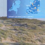
Created by the Dutch Ordnance Survey map, contains all topographic features of the landscape and thus provides an accurate picture of the terrain.Most of the maps cover and area corresponding to 12.5 x 10 kilometers. The topographic map is widely used for GPS (coordinates are neatly displayed in a grid km), scouting and survival training, but also by a growing group of hikers.

Related Products:
 Netherlands: ANWB 25K Topographic Survey Hiking Maps
 Netherlands: 25K Topographic maps
 Denmark: 100K Topographic Survey Maps
 Nepal: 50K Topographic Survey Maps
 Guadeloupe/French Antilles: 25K Topographic Survey Maps
 Switzerland: Swiss Survey 50K Standard Editions of Topographic Maps
 Faroe Islands: 20K Topographic Survey Maps
 Portugal: 50K Military Topographic Survey Maps
 Norway: New 50K Topographic Survey Maps
 Switzerland: Swiss Survey 200K Topographic Maps
 Portugal: 100K Topographic Survey Maps
Martinique: IGN 25K Topographic Survey Maps
Portugal: 100K Topographic Survey Maps
Martinique: IGN 25K Topographic Survey Maps
 Portugal: 50K Civilian Topographic Survey Maps
 Switzerland: Swiss Survey 50K Topographic Ski Maps
 Luxembourg: 50K Topographic Survey Maps
 Belgium: 50K Topographic Survey Maps
 Germany: Rhineland-Palatinate 50K Topographic Survey Recreational Maps
 Switzerland: Swiss Survey 25K Topographic Maps
 Mexico: 250K Topographic Survey Maps
 French Guiana: IGN 25K Topographic Survey Maps
 Switzerland: Swiss Survey 100K Topographic Maps
 Spain: The Way of St James 50K Topographic Survey Maps
 Peru: 100K Topographic Survey Maps
Belgium: 20K Topographic Survey Maps
Peru: 100K Topographic Survey Maps
Belgium: 20K Topographic Survey Maps
 Reunion: IGN 25K Topographic Survey Maps
 South Africa: 250K Topographic Survey Maps
 Germany: Lower Saxony 50/40K Topographic Survey Leisure Maps
 Germany: Bavarian 50K Topographic Survey Leisure Maps
 Netherlands: Falk Maps of the Conservation Areas
 France: IGN 25K TOP25/Sรฉrie Bleue Topographic Survey Maps
 Austria: 200K Topographic Survey Province Maps
Belgium: 25K Topographic Survey Maps
Austria: 200K Topographic Survey Province Maps
Belgium: 25K Topographic Survey Maps
 Switzerland: Swiss Survey 50K/33K Hiking Editions of Topographic Maps
 Germany: Baden-Wรผrttemberg 50K Topographic Survey Leisure Maps
 Israel: 100K Topographic Survey Maps
 Portugal: 25K Madeira Topographic Survey Maps
Portugal: 25K Azores Topographic Survey Maps
Portugal: 25K Madeira Topographic Survey Maps
Portugal: 25K Azores Topographic Survey Maps
 Germany: Hesse 50K Topographic Survey Leisure Maps
 Netherlands: ANWB 50K Cycling Maps