Disclosure : This site contains affiliate links to products. We may receive a commission for purchases made through these links.
Netherlands

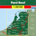
Netherlands on a large, indexed road map at 1:250,000 from Falk BV, with five city centre street plans, a route planning map, plus a distance table. Road network clearly shows motorway junction numbers and names. Driving distances are marked on main and selected local routes. Railway lines are shown with main stations and ferry connections, both internal across rivers/canals and to the North Sea islands, indicate maximum weight per vehicle. A range of symbols show various facilities and places of interest. The map has no geographical coordinates. The index is on the reverse. Map legend includes English.The reverse side also provides city centre street plans of Amsterdam, The Hague, Rotterdam, Utrecht and Maastricht. The plans show one way or restricted entry streets, pedestrian zones, car parks and police stations, but do not indicate any places of interest or other important buildings. Also provides is a motorway map for route planning and a distance tablePLEASE NOTE: the same map is also available is the publisher’s special folded format with more additional features.


