Disclosure : This site contains affiliate links to products. We may receive a commission for purchases made through these links.
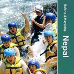
Nepal: Nepa Maps (Himalayan MapHouse) Rafting & Kayaking Maps

Nepal on three maps at 1:500,000 from the Nepa Maps (Himalayan MapHouse) designed to present the countryโ€s river network classified according to the suitability for white water rafting and kayaking, with water volume profiles, etc.Each title shows the river network graded into five classes. Additional panels list rivers with rafting and kayaking summaries, providing stretch-by stretch information about class, volume, scenery, number of days, etc. Also provided are month-by-month profiles of high and low water ratios.The maps have relief shading to show Nepalโ€s topography and present the countryโ€s network of roads and tracks, with symbols highlighting locations of local airports, campsites and other tourist accommodation, various places of interest, etc. The maps are indexed and have latitude and longitude lines at intervals of 30โ€.All the information is in English.

Related Products:
 Western Nepal Rafting and Kayaking Map
Central Nepal Rafting Map
Western Nepal Rafting and Kayaking Map
Central Nepal Rafting Map
 Nepal: Nepa Trekking and Hiking Maps
 Nepal: Himalayan MapHouse Trekking Map 100 Series with the Great Himalaya Trail
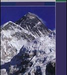
 White Water Nepal
 Nepal: NGS Adventure Maps
 Nepal: 50K Topographic Survey Maps
 Kayaking – A Beginner`s Guide
 India: Nelles Regional Road Maps
 Inflatable Kayaking: A Beginner`s Guide
 Nepal: Alpenverien Trekking Maps
 Oileain – the Irish Islands Guide – Sea Kayaking
Nepal: Schneider Trekking Maps
Oileain – the Irish Islands Guide – Sea Kayaking
Nepal: Schneider Trekking Maps
 Spain: CNIG Road Maps of Autonomous Administrative Regions
 The Outer Hebrides: Sea Kayaking Around the Isles & St Kilda
 Austria: Freytag & Berndt 200K Road Maps
 France: AA Regional Touring Maps
 Nepal: Leomann Trekking Maps
 Nepal Gecko Map
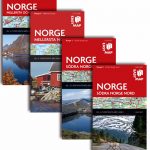 Norway: Norstedts Regional Road Maps
 Iceland: Mรกl og Menning Touring and Hiking Maps
 Nepal Adventure Map
 South West Sea Kayaking: Isle of Wight to the Severn Estuary
 West of Scotland Sea Kayaking Map
 Iceland: Mรกl og Menning 300K Road Maps
 Israel: 100K Topographic Survey Maps
 Switzerland: Kรผmmerly + Frey 60K Cycling Maps
 USA: Michelin Zoom Maps
 Hungary: Cartographia Hiking Maps
 Indonesia: Periplus Regional Maps
 Great Britain: A-Z Regional Road Maps and Atlases
 Spain: The Way of St James 50K Topographic Survey Maps
 Croatia: Mountain Rescue Service Recreational Maps
 South Africa: 250K Topographic Survey Maps
 Thailand: ThinkNet Regional Road Maps
 Canada: Go Trekkers Maps of National Parks
 Spain: Editorial Piolet Hiking Maps
 Mexico: ITMB Regional Road Maps
 Himalayan Flowers of Nepal
 Greece: Anavasi Hiking Maps of the Mainland and Peloponnese