Disclosure : This site contains affiliate links to products. We may receive a commission for purchases made through these links.
Nepal Nelles
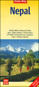
Nepal on a waterproof and tear-resistant map from Nelles, presenting the whole country at 1:1,500,000, with its more visited central and eastern regions also shown in more detail at 1:480,000, plus enlargement of the Kathmandu Valley and the Rara Lake area and street plans of central Kathmandu City, Patan, Bhaktapur and the lakeside district of Pokhara.On one side the whole of Nepal is shown at 1:750,000; on the reverse a more detailed map at 1:480,000 covers central and eastern Nepal including the country’s main trekking areas: from the Dhaulagiri peaks in the west, across the Annapurna region, Langtang and Mt Everest, to Kanchenjunga in the east. Topography is indicated by relief shading with spot heights and names of mountain ranges, peaks and passes, etc, plus boundaries of national parks and conservation areas. Road network includes selected cart tracks and trekking routes, with distances marked on main routes. Symbols show locations with access by air transport, as well as various places of interest. Latitude and longitude are indicated by margin ticks at 2ยบ (whole country map) or 1ยบ intervals. The maps are not indexed. Map legend includes English.Enlargements present in greater detail Kathmandu Valley (1:75,000 approx) and the Jomsom to Rara Lake region (1:1m). Street plans cover central Kathmandu City with a further enlargement for its Thamel area, Patan, Bhaktapur, plus the lakeside district of Pokhara. The plans highlight selected hotels and various places of interest. For Kathmandu City, Patan and Bhaktapur there are also plans of their Durbar Square historic centres.

Related Products:
 Kathmandu City – Patan – Bhaktapur
 Nepal Reise Know-How
 Nepal: NGS Adventure Maps
 Nepal Adventure Map
 The Rough Guide to Nepal
 Nepal Gecko Map
 Annapurna NGS Adventure Map 3003
 Nepal ITMB
 Langtang NGS Adventure Map 3004
 Khumbu NGS Adventure Map 3002
 Nepal Trekking
 Pokhara City – Lake Side Valley
 Everest Base Camp NGS Adventure Map 3001
 Lonely Planet Nepal
 Nepal
Nepal
 The Prisoner of Kathmandu: Brian Hodgson in Nepal 1820-43
 Central Nepal Rafting Map
 Philippines – Manila Nelles
 Cuba Nelles
 Nepal Geological Map
 Mexico Nelles
 Malaysia West – Singapore Nelles
 Central Asia Nelles
 Insight Guides Nepal
Taiwan Nelles
Insight Guides Nepal
Taiwan Nelles
 Vietnam – Laos – Cambodia Nelles
 India North Nelles
 Battles of the New Republic: A Contemporary History of Nepal
 South America – The Andes Nelles
 Argentina North – Uruguay Nelles
Western Nepal Rafting and Kayaking Map
Argentina North – Uruguay Nelles
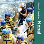
Western Nepal Rafting and Kayaking Map
 Bangladesh & India East ITMB
 Malaysia – Brunei Nelles
 Thailand Nelles
 History of Nepal
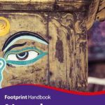 Nepal Footprint Handbook
 Sri Lanka Nelles
 Peru – Ecuador Nelles
 India East Nelles
 Shopping for Buddhas: An Adventure in Nepal