Disclosure : This site contains affiliate links to products. We may receive a commission for purchases made through these links.
Navi Mumbai Street Atlas

Navi Mumbai City Map from Eicher Goodearth, indexed by road and place name and at a scale of 1:12,500, is actually more accurately described as a street atlas. Coverage includes Vasai, Virar, New Panvel and Uran. The map shows road networks; arterial, local main and other roads, as well as one way streets, pedestrian subways, petrol stations and traffic lights. Rail lines and stations are marked, as are ferry routes, and taxi stands. Local facilities and places of interest are shown, including information centres and hotels and municipal and visitor/cultural sites. Additionally, the location of overhead and land level water tanks in the area are extensively documented on the map. Building and land type is indicated, with street numbers and list of abbreviations given.A route planner map of Navi Mumbai is included.

Related Products:
 Mumbai (Bombay) Street Atlas
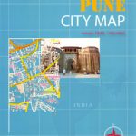 Pune City Street Atlas
 Kolkata / Calcutta Street Atlas
 Chennai / Madras Street Atlas
 Gloucestershire Philip`s Street Atlas
 Surrey Philip`s Street Atlas
 Cornwall Philip`s Street Atlas
 Dorset Philip`s Street Atlas
 Wiltshire and Swindon Philip`s Street Atlas
 Skopje Street Atlas
 Johannesburg Map Studio Pocket Map
 Delhi Street Atlas
 Derbyshire Philip`s Street Atlas
 Devon Philip`s Street Atlas
 Norfolk Philip`s Street Atlas
 Mumbai / Bombay – India West Coast ITMB
 Quebec City and Environs Street Atlas
 Zurich Street Atlas
 Bergen Cappelen Street Plan
 Prague Street Atlas
 Winnipeg Pocket Street Atlas
 Winnipeg and Area Street Atlas
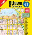 Ottawa and Environs Street Atlas
 Bristol – Bath A-Z Street Atlas
 Surrey A-Z Street Atlas
 Manchester A-Z Big Street Atlas SPIRAL-BOUND
 Lithuania – Vilnius Street Plan
 Bolton – Bury A-Z Street Atlas
 Montreal & Environs Street Atlas
 Outaouais – Laurentides – Abitibi Street Atlas
 Hamilton – Burlington – Oakville Street Atlas
 West Midlands – Birmingham – Coventry – Wolverhampton A-Z Street Atlas
 Nottinghamshire A-Z County Street Atlas
 West Sussex A-Z Street Atlas
 West Yorkshire – Leeds – Bradford A-Z Street Atlas
 Kitchener – Waterloo Street Atlas
 Belarus Road Atlas
 Bournemouth – Poole – Christchurch A-Z Street Atlas
 Bucharest Street Atlas
 Aberdeen A-Z Street Atlas