Disclosure : This site contains affiliate links to products. We may receive a commission for purchases made through these links.
Natural Resources Canada North Circumpolar Region Wall Map – Bilingual – Atlas of Canada 1087 x 921 mm
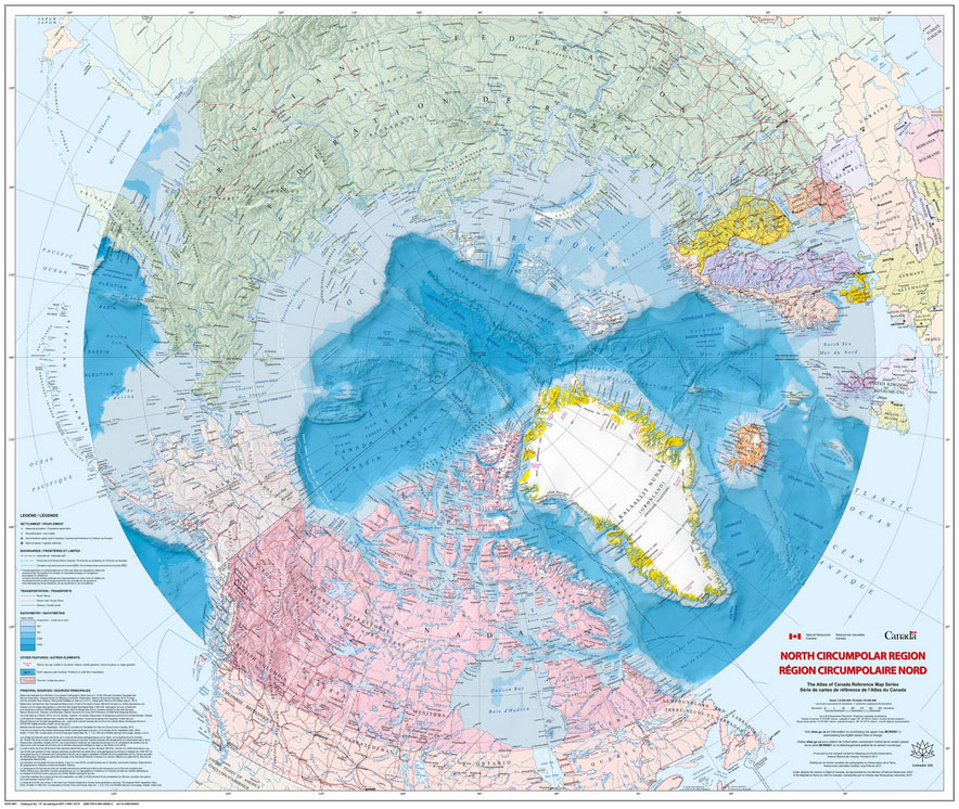
The Arctic Sea and the North Circumpolar Region on a beautiful wall map from Natural Resources Canada, the country’s topographic survey organization. The map covers an area north of 55ยบ of latitude, with countries presented in lovely pastel colours against the surrounding seas which have bathymetric colouring. Relief shading shows the terrain on land and the sea bed, where ridges and basin are named. Glaciated areas are indicated and the map shows both the limit of permanent polar sea ice (from 1972 to 2007) and the tree line on land. Latitude lines are drawn at intervals of 5ยบ, with longitude at 10ยบ.This is a Print On Demand map


