Disclosure : This site contains affiliate links to products. We may receive a commission for purchases made through these links.
National Geographic Central Asia – Atlas of the World 10th Edition


Related Products:
 National Geographic Greenland – Atlas of the World 10th Edition
 National Geographic The Caucasus – Atlas of the World 10th Edition 711 x 559 mm
 National Geographic Northeastern Africa – Atlas of the World 10th Edition
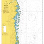
 National Geographic Indian Ocean Floor – Atlas of the World 10th Edition
 National Geographic Student World Atlas
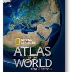 National Geographic Atlas of the World, Tenth Edition
 National Geographic Family Reference Atlas of the World
 National Geographic Atlas of the World Eleventh Edition
 National Geographic Kids My First Atlas of the World: A Child`s First Picture Atlas
 National Geographic Kids Beginner`s World Atlas (Atlas)
 National Geographic Visual Atlas Of The World, 2nd Edition: Fully Revised and Updated
 National Geographic the British World: An Illustrated Atlas
 National Geographic Kids World Atlas, 5th Edition
 World Atlas: It`s your planet. Learn it. Love it. Explore it. (National Geographic Kids)
 National Geographic Europe Map with Africa and Asia – Published 1915 796 x 719 mm
 Philip`s RGS World Atlas: 10th Edition PAPERBACK
 National Geographic Africa Map with portions of Europe and Asia – Published 1922 721 x 798 mm
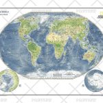 MapSherpa POD Physical World Map – Atlas of the World 10th Edition 711 x 559 mm
 National Geographic Central Europe and the Mediterranean – Published 1939
 National Geographic New Balkan States and Central Europe – Published 1914 455 x 578 mm
 The World – The National Geographic 125th Anniversary Wall Map PAPER
 The World – The National Geographic 125th Anniversary Wall Map ENCAPSULATED
 National Geographic Kids Ultimate Space Atlas
 National Geographic Family Reference Atlas, 5th Edition
 National Geographic World Explorer 813 x 511 mm
 National Geographic World Executive 1166 x 773 mm
 National Geographic World – Published 1935 1107 x 579 mm
 National Geographic World Executive Spanish – Published 2005 988 x 646 mm
 National Geographic The Photo Ark Vanishing: The World`s Most Vulnerable Animals
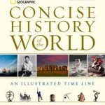 National Geographic Concise History of the World: An Illustrated Time Line
 The World`s Most Amazing Places: 1000 incredible facts (National Geographic Kids)
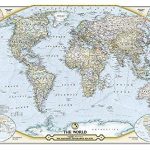
 World: National Geographic Society Classic Style Political Wall Maps
 World: National Geographic Society Executive Style Political Wall Maps
 World: National Geographic Society Decorator Style Political Wall Maps
 Our World Quiz Book: 300 brain busting trivia questions (National Geographic Kids)
 Soviet Asia: Soviet Modernist Architecture in Central Asia
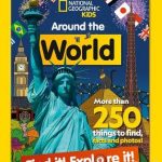 Around the World Find it! Explore it!: More than 250 things to find, facts and photos! (National Geographic Kids)
 Philip`s Junior School Atlas 10th Edition
 Puzzle Book What in the World: Brain-tickling quizzes, sudokus, crosswords and wordsearches (National Geographic Kids Puzzle Books)
 World Rail Atlas and Historical Summary: Vol. 7 North, East and Central Africa