Disclosure : This site contains affiliate links to products. We may receive a commission for purchases made through these links.
Namibia InfoMap
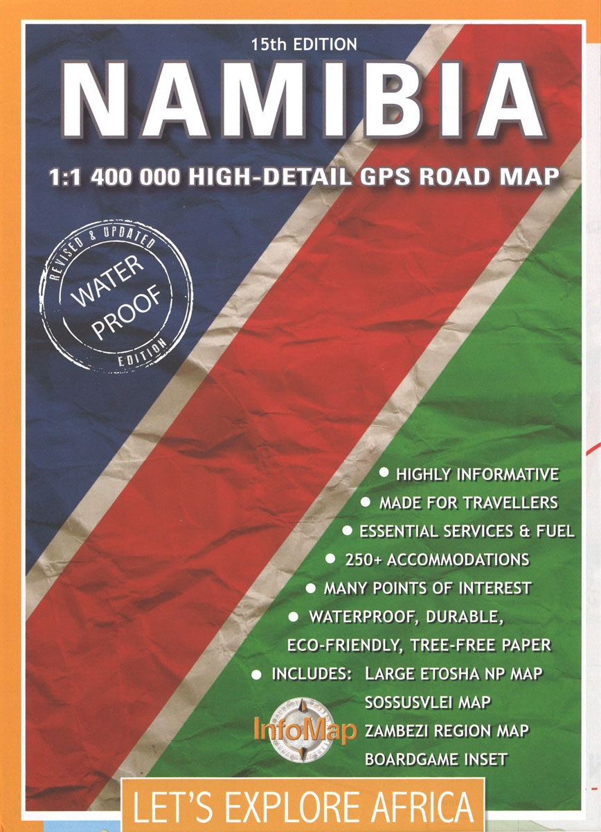
Namibia at 1:1,400,000 on a double-sided, waterproof and tear-resistant road map from South African publishers International Motoring Productions with GPS waypoints for selected road junctions, small towns or settlements, places of interest and recommended accommodation, plus enlargements showing in greater detail Etosha National Park, the Zambezi Region, and the area around the Twyfelfontein Rock Engravings UNESCO World Heritage site.Road network indicates tar or gravel roads and 4WD tracks; locations of fuel stations are marked and driving distances are shown on all routes. Many road junctions and other points such as park entry gates, etc, are annotated with GPS waypoints. Border crossings to neighbouring countries show their opening times. The map also shows locations accessible by air transport. Symbols mark recommended accommodation (shown with names of camps, etc) and various places of interest. Towns are annotated to indicate what services are provided there (shops, ATMs, car repairs, medical, etc). The map, one of a series of similar maps covering countries and selected regions of southern Africa, has rather simple cartography with somewhat basic elevation tinting and occasional spot heights. Perennial or seasonal rivers and dry pan are marked and main mountain ranges are named; main protected areas are highlighted. The areas outside the country’s borders show only main road connections. In addition to the waypoints, latitude and longitude are drawn at 1ยบ intervals. Each side of the map has a panel listing accommodation facilities with phone numbers, star rating and GPS waypoints.

Related Products:
 Kaokoland – North Western Namibia InfoMap
 Zambia InfoMap
 Lesotho InfoMap
 Zimbabwe InfoMap
 Namibia Map Studio Adventure Map
 Botswana InfoMap
 South Africa: InfoMap Touring Maps
 Swaziland
 Namibia Map Studio Road Atlas
 Mozambique and Malawi
 Cape West Coast – Cederberg & Tankwa Karoo InfoMap
 Angola InfoMap
 Zambia Road Map
 Namibia ITMB
 Kruger National Park
 Garden Route & Route 62 Map Studio
 Damaraland
 Richtersveld National Park and Northern Namaqualand
 Zimbabwe National Parks Map
 Western Cape Map Studio
 South Africa Map Studio Road Atlas A4 PAPERBACK
 Drakensberg and the Eastern Free State
 Zimbabwe Map Studio Adventure Map
 South Africa InfoMap
 Estonia: Regio 275K Regional Road Maps
 Transkei Wild Coast
 Megaliesberg – Pilanesberg and the Waterberg
 South Africa – Namibia – Botswana Marco Polo Map
 Swartberg and Klein-Karoo
Lesotho Map Studio Adventure Map
Swartberg and Klein-Karoo
Lesotho Map Studio Adventure Map
 South Africa – Namibia – Botswana – Zimbabwe Nelles
 Namibia 3in1 Flash Guide
 Latgale South Jana Seta Tourist Map
 Kurzeme South Jana Seta Tourist Map
 Central Latvia Jana Seta Tourist Map
 Botswana Tourist Map
 Namibia Tracks4Africa
 Mozambique Pocket Map
 Pilbara and Coral Coast Hema Waterproof Map
 Cape York – Old Telegraph Track Hema