Disclosure : This site contains affiliate links to products. We may receive a commission for purchases made through these links.
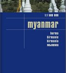
Myanmar / Burma Nelles
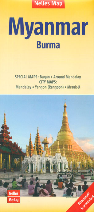
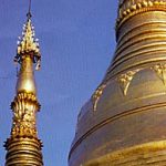
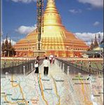
Myanmar /Burma at 1:1,500,000 from Nelles Verlag, now published on a handy size, light, waterproof and tear-resistant map, with street plans of Yangon (Rangoon) and Mandalay, plus plans of the UNESCO World Heritage site at Bagan and of the ancient capital at Mrauk-U. The map is double-sided, with its smaller size offering a convenient format for use when travelling. The country is divided north/south, with Mandalay included on both sides and the panhandle shown as an inset on the southern side. Vivid relief shading with spot heights and names of mountain ranges presents the topography. National parks and/or protected area are indicated. Road network indicates partially paved roads and cart tracks. Railway lines and local airports are included and the map also shows internal administrative boundaries with names of the provinces. Various places of interest are prominently marked. Latitude and longitude margin ticks are at 1ยฐ intervals. The map has no index of localities. Map legend includes English.Insets provide: a street plan of Yangon (Rangoon) with an enlargement of its downtown area, a street plan of Mandalay with a detailed map of the area around the city, an enlargement of the Bagan area with a more detailed plan of Old Bagan, plus an enlargement showing the temples and archaeological sites in Mrauk-U. All these maps highlight places of interest; street plans also indicate selected hotels, restaurants, etc.

Related Products:
 Myanmar / Burma ITMB
 Myanmar / Burma Periplus Travel Map
 Yangon & Myanmar (Burma) Odyssey Map
 The Rough Guide to Myanmar (Burma)
 Mandalay & Myanmar (Burma) Odyssey Map
 DK Eyewitness Travel Guide Myanmar (Burma)
 Cuba Nelles
 Tunisia Nelles Map
 Bolivia – Paraguay Nelles
 Malaysia West – Singapore Nelles
 Myanmar / Burma F&B
 Argentina North – Uruguay Nelles
 Java – Jakarta Nelles
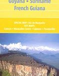 Venezuela, Guyana, Suriname & French Guiana Nelles Map
 Cambodia – Angkor Nelles
 Nay Pyi Taw & Yangon (Rangoon) Odyssey Map
 Myanmar / Burma Reise Know-How
 Philippines – Manila Nelles
 Central Asia Nelles
 Central America Nelles
 Taiwan Nelles
 Peru – Ecuador Nelles
 Colombia – Ecuador Nelles
 Afghanistan Nelles Map
 Thailand – Vietnam – Myanmar / Burma – Cambodia – Laos Marco Polo Map
 South America – The Andes Nelles
 Sri Lanka Nelles
 Yangon: Historical Walks Map
 Hawaii – Oahu – Honolulu Nelles
 Nay Pyi Taw & Myanmar (Burma) Odyssey Map & Booklet Pack
 111 Places in Myanmar That You Shouldn`t Miss
 Pakistan Nelles
 Malaysia – Brunei Nelles
 China North East Nelles Map
 Nepal Nelles
 Bali – Lombok Nelles
Kenya – Serengeti Nelles
Bali – Lombok Nelles
Kenya – Serengeti Nelles
 New Zealand Nelles