Disclosure : This site contains affiliate links to products. We may receive a commission for purchases made through these links.
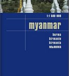
Myanmar / Burma ITMB
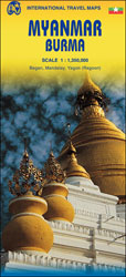
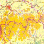
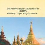
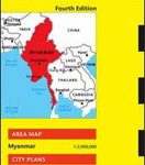
Indexed map of Burma at 1:1,350,000 from ITMB with large, clear street plans of central Yangon (Rangoon) and Mandalay, plus an enlargement of the Bagan area. The map is double-sided, dividing the county north-south with an overlap between the sides; each side is provided with a separate index of localities.Altitude colouring presents the topography, with spot heights given in feet. The map shows the country’s road and rail networks, as well as locations of local airports. National parks and various places of interest are highlighted. Also shown are local administrative boundaries with names of the provinces. Latitude and longitude grid is at intervals of 1ยบ.The map includes street plans of Yangon (Rangoon) and Mandalay, annotated with symbols showing accommodation and other tourist facilities, temples and places of interest, etc. Also included is an enlargement at 1:40,000 of the Bagan area, highlighting its numerous temples and pagodas.

Related Products:
 Myanmar / Burma Nelles
 Myanmar / Burma Periplus Travel Map
 Yangon & Myanmar (Burma) Odyssey Map
 Mandalay & Myanmar (Burma) Odyssey Map
 DK Eyewitness Travel Guide Myanmar (Burma)
 The Rough Guide to Myanmar (Burma)
 Hue – Da Nang & Vietnam Centra ITMB
 Myanmar / Burma F&B
 Myanmar / Burma Reise Know-How
 Nay Pyi Taw & Yangon (Rangoon) Odyssey Map
 Thailand, Vietnam, Laos & Cambodia ITMB Travel Atlas
 Thailand – Vietnam – Myanmar / Burma – Cambodia – Laos Marco Polo Map
 Southern Vietnam – Mekong Delta ITMB
 Vietnam ITMB
 Colombia ITMB
 Myeik Archipelago & Myanmar (Burma) Odyssey Map
 Accra & Ghana South ITMB
 Guatemala ITMB
 California ITMB
 Nigeria & Niger ITMB
 Senegal & Gambia ITMB
 Cuba West ITMB
 Bhutan & Northeast India ITMB
 Nepal ITMB
 Java ITMB
 111 Places in Myanmar That You Shouldn`t Miss
 Japan North & Hokkaido ITMB
 Thailand ITMB
 Bolivia ITMB
 Peru ITMB
 Bangladesh & India East ITMB
 Nay Pyi Taw & Myanmar (Burma) Odyssey Map & Booklet Pack
 Malaysia ITMB
 Sarawak – Sabah – Brunei ITMB
 Togo & Benin ITMB
 Malawi & Mozambique ITMB
 Belize & Eastern Guatemala ITMB
 Ghana ITMB