Disclosure : This site contains affiliate links to products. We may receive a commission for purchases made through these links.
Murray River and Mallee, SA
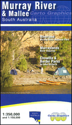
The Murray River and the Mallee region of South Australia from Lake Victoria in NSW to Lake Alexandrina on an indexed touring map at 1:350,000 from Carto Graphics, with on the reverse the area along the river presented in greater detail on nine panels at 1:150,000.On one side is a regional map at 1:350,000 extending from just north of the Murray to Lake Alexandrina, Lake Albert and the Younghusband Peninsula on the coast in the southwest and the Ngarkat Conservation Park in the south-east. The map shows the region’s road network with driving distances on main routes and highlights locations of visitor information centres, campsites and viewpoints. Protected areas are highlighted. Latitude and longitude lines are drawn at 15’ intervals. The index includes a list of parks and reserves.On the reverse nine panels present the areas adjoining the 740-km stretch of the Murray at 1:150,000 showing creeks, lagoons, areas subject to inundation, etc. 10-km markers indicate the distance from the river’s mouth. Road network is shown in greater detail, and additional symbols indicate boat ramps, pumpout stations and river locks, more campsites, wineries, etc.To see the list of the publisher`s other regional maps of South Australia please click on the series link.


