Disclosure : This site contains affiliate links to products. We may receive a commission for purchases made through these links.
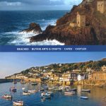
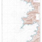
Muro de Aguas CNIG Topo 281-1


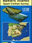
Related Products:
 Siete Aguas CNIG Topographic Map 720-II
 Muro CNIG 25K Topographic Map 671-4
Muro de Alcoy CNIG Topographic Map 821-I
Muro CNIG 25K Topographic Map 671-4
Muro de Alcoy CNIG Topographic Map 821-I
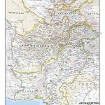
 Directrices Para Los Buques Que Naveguen En Aguas Polares
 Mallorca – Alcudia – Playa de Muro – C`an Picafort
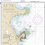
 SHOM Chart 7162 – Du Cap Muro au Cap de Feno
 SHOM Chart 7162L – Du Cap Muro au Cap de Feno – Leisure A4 size
 SHOM Chart 6942 – De Punta d’Orchina au Cap Muro – Abords d’Ajaccio
Gor CNIG Topo 993-4
Ena CNIG Topo 209-1
Ara CNIG Topo 210-1
Foz CNIG Topo 9-4
Ona CNIG Topo 136-3
Valdeolivas CNIG Topo 538-3
Entrimo CNIG Topo 301-1
Yuncos CNIG Topo 604-2
Miralsot CNIG Topo 387-3
Vallejudio CNIG Topo 731-2
Huescar CNIG Topo 950-2
Quiroga CNIG Topo 189-2
Canaveras CNIG Topo 563-3
Zafrilla CNIG Topo 588-4
Titaguas CNIG Topo 638-3
Cardenete CNIG Topo 664-2
Tourinan CNIG Topo 67-4
Melon CNIG Topo 224-2
Truchillas CNIG Topo 230-3
Lubian CNIG Topo 266-4
Leiva CNIG Topo 169-3
Anguiano CNIG Topo 241-1
Barasoain CNIG Topo 173-2
Plan CNIG Topo 179-4
Biel CNIG Topo 208-4
La Socarrada CNIG Topo 283-4
Santalla CNIG Topo 49-1
Cirujales CNIG Topo 128-1
Almanza CNIG Topo 163-1
San Emiliano CNIG Topo 50-1
Belorado CNIG Topo 201-2
Mecerreyes CNIG Topo 276-2
SHOM Chart 6942 – De Punta d’Orchina au Cap Muro – Abords d’Ajaccio
Gor CNIG Topo 993-4
Ena CNIG Topo 209-1
Ara CNIG Topo 210-1
Foz CNIG Topo 9-4
Ona CNIG Topo 136-3
Valdeolivas CNIG Topo 538-3
Entrimo CNIG Topo 301-1
Yuncos CNIG Topo 604-2
Miralsot CNIG Topo 387-3
Vallejudio CNIG Topo 731-2
Huescar CNIG Topo 950-2
Quiroga CNIG Topo 189-2
Canaveras CNIG Topo 563-3
Zafrilla CNIG Topo 588-4
Titaguas CNIG Topo 638-3
Cardenete CNIG Topo 664-2
Tourinan CNIG Topo 67-4
Melon CNIG Topo 224-2
Truchillas CNIG Topo 230-3
Lubian CNIG Topo 266-4
Leiva CNIG Topo 169-3
Anguiano CNIG Topo 241-1
Barasoain CNIG Topo 173-2
Plan CNIG Topo 179-4
Biel CNIG Topo 208-4
La Socarrada CNIG Topo 283-4
Santalla CNIG Topo 49-1
Cirujales CNIG Topo 128-1
Almanza CNIG Topo 163-1
San Emiliano CNIG Topo 50-1
Belorado CNIG Topo 201-2
Mecerreyes CNIG Topo 276-2