Disclosure : This site contains affiliate links to products. We may receive a commission for purchases made through these links.
Munich – South Tyrol – Upper Bavaria 3in1 Flash Guide
Southern Bavaria, Austrian Tyrol and Italy’s South Tyrol region including the Dolomites, on a waterproof and tear-resistant, large and double-sided map at 1:175,000 from the Swiss Hallwag/Kรผmmerly + Frey cartographic house, highlighting the region’s 77 best sights, each with a brief description, plus street plans of central Munich, Innsbruck and Merano.Coverage on the map’s northern side extends Munich to Innsbruck, and from Fรผssen with the Neuschwanstein Castle to Salzburg. The southern side extends from Innsbruck to well south of Bolzano, and from the Engadine Valley along the Inn in Switzerland and Bormio eastwards to past Dobbiaco/Toblach and Cortina d’Ampezzo in the Dolomites.Road network, including small local roads and selected country tracks, is clearly laid out on a base showing the region’s topography by relief shading with plenty of names of mountain ranges, peaks, valleys, etc. Scenic routes are highlighted. 77 best sights are cross-referenced to the surrounding panels of brief descriptions, many illustrated with photos. The map has no geographical coordinates. The index lists a selection of towns.Also included are small street plans of Munich, Innsbruck and Merano annotated with main sights. Map legend and all the text include English.

Related Products:
 South Tyrol – Lake Garda – Venice 3in1 Flash Guide
 Vorarlberg – Tyrol – Upper Bavaria – South Tyrol 200K Marco Polo Zoom Map
Upper Bavaria – Tyrol – South Tyrol Motorcycle Map
Vorarlberg – Tyrol – Upper Bavaria – South Tyrol 200K Marco Polo Zoom Map
Upper Bavaria – Tyrol – South Tyrol Motorcycle Map
 Bavaria South – Upper Bavaria – Chiemsee – Passau – Munich 2-Map Cycling Set Kompass 3712
Bavaria South – Munich – Upper Bavaria K+F Road Map 8
Bavaria South – Upper Bavaria – Chiemsee – Passau – Munich 2-Map Cycling Set Kompass 3712
Bavaria South – Munich – Upper Bavaria K+F Road Map 8
 Munich – Upper Bavaria – Augsburg – Innsbruck – Salzburg – Passau Falk Regional Map 16
 South Tyrol – Bolzano F&B Top 10 Tips
 Tuscany 3in1 Flash Guide
 South Tyrol Wine Route – Merano – Bolzano 2-Map Set Kompass 078
 Sardinia 3in1 Flash Guide
 Upper Bavaria – Munich Cycling Map 26
 South Tyrol – Dolomites Tabacco Road and Panorama Map
 South Tyrol Cycle Region Bikeline Map-Guide
South Tyrol Cycling Map
South Tyrol Cycle Region Bikeline Map-Guide
South Tyrol Cycling Map
 Berlitz Pocket Guide Munich and Bavaria
 Tyrol – Dolomites Road and Panorama F&B
 Namibia 3in1 Flash Guide
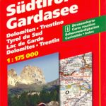 South Tyrol – Lake Garda
 Munich + Bavaria – the Architecture Guide
 Austria – Liechtenstein – South Tyrol Marco Polo Road Atlas
 South Tyrol Kompass Hiking & Recreational Kompass Ring-binder Atlas No. 2703: Bormio – Merano – Bolzano – Cortina d`Ampezzo
 Munich & Bavaria ITMB
 South Tyrol Cycle Route Bikeline Map-Guide Compact
 Zillertal Alps: Trekking and Peaks in the Austrian Tyrol and Italian South Tyrol
 South Tyrol – Dolomites 4-Map Set Kompass 699
 Switzerland 3in1 Flash Guide
 Croatian Coast Flash Map-Guide
 Munich-Venice Long Distance Cycle Route – incl Dolomites Route Bikeline Map-Guide
 Insight Guides Pocket Munich & Bavaria (Travel Guide with Free eBook)
 Bolzano Vignetei e Dolomiti / Southern South Tyrol Kompass 74
 Tyrol F&B Top 10 Tips
 Blue Guide Trentino & the South Tyrol
 South Tyrol – Trentino – Lake Garda – Veneto F&B
 Munich Borch
 Lake Garda – South Tyrol High 5 Edition Adventure Map
 South Tyrol – Trentino – Lake Garda ADAC Holiday Map
 South America – The Andes Nelles
Upper Bavaria River Cycle Routes Bikeline Map-Guide
South Tyrol – Trentino – Lake Garda Cycling Map 28
South America – The Andes Nelles
Upper Bavaria River Cycle Routes Bikeline Map-Guide
South Tyrol – Trentino – Lake Garda Cycling Map 28