Disclosure : This site contains affiliate links to products. We may receive a commission for purchases made through these links.
Munich North and West – Freising – Dachau – Fรผrstenfeldbruck – Unterschleissheim UK50-40

Related Products:
 Munich East – Erding – Garching – Dorfen – Grafing – Markt Schwaben UK50-42
 Altmuhltal NP West UK50-23
 Spessart NP North UK50-06
 Munich North N11
 Mountain Biking in West and North West Scotland
 Shetland: Mainland North West – North Roe & Sullom Voe OS Explorer Active Map 469 (waterproof)
 Shetland: Mainland North West – North Roe & Sullom Voe OS Explorer Map 469 (paper)
 The Dressmaker of Dachau
 Lower Saxony West – North Rhine-Westphalia North 2-Map Cycling Set Kompass 3704
 Freising M12
 Freising – Erding – Markt Schwaben Kompass 183
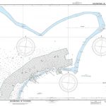
 Admiralty Chart Folio 90 – West Coast North America – Cape Mendocino to Vancouver Island including West Coast of Vancouver Island
 Svalbard North-West
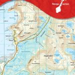
 North West Friesland
 Iceland North West
 North West Highlands
 Leicester North West 1902
Wolverhampton North West 1901
Worcester North-West 1902
North West Surrey 1888
Leicester North West 1902
Wolverhampton North West 1901
Worcester North-West 1902
North West Surrey 1888
 India North and West ITMB
North West Gloucestershire 1896
Switzerland North West Swisstopo 1
India North and West ITMB
North West Gloucestershire 1896
Switzerland North West Swisstopo 1
 Estonia North-West Regio Map
 Vilnius North West and Its Environs
 Iceland North-West IDNU 1
 China North-West Wall Map
 Africa North & West Michelin
 France North-West IGN Road Map
 North York Moors West AA Walker`s Map 19
 Limpopo & North West Map Studio Pocket Map
 Hanworth and North West Hampton 1934
 The North West Trail Cycle Route
 Germany North West Michelin Regional 541
 Italy North West Michelin Regional 561
 Cycling Climbs of North-West England
 Skye and North West Highlands Sea Kayaking
 France North-West IGN OACI Chart
 NP54 North Sea (West) Pilot – Digital
 North West Warmia-Masuria Cycling Map