Disclosure : This site contains affiliate links to products. We may receive a commission for purchases made through these links.
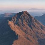
Muimenta CNIG Topo 48-1

Related Products:
 Gor CNIG Topo 993-4
Ena CNIG Topo 209-1
Ara CNIG Topo 210-1
Foz CNIG Topo 9-4
Gor CNIG Topo 993-4
Ena CNIG Topo 209-1
Ara CNIG Topo 210-1
Foz CNIG Topo 9-4
 Ona CNIG Topo 136-3
Mondonedo CNIG Topo 24-1
Moratalla CNIG Topo 889-4
Lobios CNIG Topo 301-3
Camarenilla CNIG Topo 604-3
Fraga CNIG Topo 387-4
Fermoselle CNIG Topo 423-1
Andoain CNIG Topo 64-4
Taravilla CNIG Topo 514-4
La Garrovilla CNIG Topo 777-1
Los Laneros CNIG Topo 950-3
Luzaga CNIG Topo 488-1
Huete CNIG Topo 608-1
Algarra CNIG Topo 612-3
Alpuente CNIG Topo 638-4
El Robledillo CNIG Topo 711-4
Vicorto CNIG Topo 867-2
Pedreda CNIG Topo 73-3
Ponteareas CNIG Topo 224-3
Villamanan CNIG Topo 232-2
Villardeciervos CNIG Topo 306-2
Casalarreina CNIG Topo 169-4
Arnedillo CNIG Topo 242-4
Alkotz CNIG Topo 90-4
Plan CNIG Topo 179-4
La Socarrada CNIG Topo 283-4
Maderne CNIG Topo 49-3
Lois CNIG Topo 105-1
Riello CNIG Topo 128-2
Bembibre CNIG Topo 159-1
Saldana CNIG Topo 164-3
Bahillo CNIG Topo 197-2
Atapuerca CNIG Topo 201-3
Lerma CNIG Topo 276-3
Cisneros CNIG Topo 234-4
Algete CNIG Topo 535-1
Ona CNIG Topo 136-3
Mondonedo CNIG Topo 24-1
Moratalla CNIG Topo 889-4
Lobios CNIG Topo 301-3
Camarenilla CNIG Topo 604-3
Fraga CNIG Topo 387-4
Fermoselle CNIG Topo 423-1
Andoain CNIG Topo 64-4
Taravilla CNIG Topo 514-4
La Garrovilla CNIG Topo 777-1
Los Laneros CNIG Topo 950-3
Luzaga CNIG Topo 488-1
Huete CNIG Topo 608-1
Algarra CNIG Topo 612-3
Alpuente CNIG Topo 638-4
El Robledillo CNIG Topo 711-4
Vicorto CNIG Topo 867-2
Pedreda CNIG Topo 73-3
Ponteareas CNIG Topo 224-3
Villamanan CNIG Topo 232-2
Villardeciervos CNIG Topo 306-2
Casalarreina CNIG Topo 169-4
Arnedillo CNIG Topo 242-4
Alkotz CNIG Topo 90-4
Plan CNIG Topo 179-4
La Socarrada CNIG Topo 283-4
Maderne CNIG Topo 49-3
Lois CNIG Topo 105-1
Riello CNIG Topo 128-2
Bembibre CNIG Topo 159-1
Saldana CNIG Topo 164-3
Bahillo CNIG Topo 197-2
Atapuerca CNIG Topo 201-3
Lerma CNIG Topo 276-3
Cisneros CNIG Topo 234-4
Algete CNIG Topo 535-1