Disclosure : This site contains affiliate links to products. We may receive a commission for purchases made through these links.
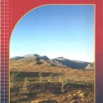
Mourne Mountains Harvey XT25 Superwalker Map

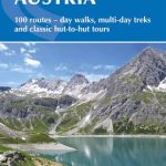
This Mourne Mountains Superwalker Map covers the highest mountains in Northern Ireland, an Area of Outstanding Natural Beauty. The Mournes are a granite mountain range in County Down, with the highest peak being Slieve Donard at 850 metres. This detailed map for hillwalkers of the Mountains of Mourne at a scale of 1:25,000, and includes The Mourne Way Long Distance Footpath.The Mourne Wall is among the more famous features in the Mournes. It is a 35km (22mls) drystone wall that crosses fifteen summits, constructed in 1904 and completed in 1922 to define the boundaries of land purchased by the Belfast Water Commissioners in the late 1800s.Superwalker maps are tough, light, durable and 100% waterproof, plus they are easy to re-fold.

Related Products:
 Big Hikes in the Mourne Mountains: 7 different routes for the Seven Sevens, the Mourne Wall Walk, the Mourne 500 & more
 The Mourne Mountains: The 30 best hikes, handpicked by a County Down local
 Wicklow Mountains Harvey Superwalker XT30
 Lake District West Harvey Superwalker XT25
 Lake District North Harvey Superwalker XT25
 Arrochar Alps Harvey Superwalker XT25
 Torridon Harvey Superwalker XT25
 Ben Lawers and Schiehallion Harvey Superwalker XT25
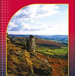
 Peak District South Harvey Superwalker XT25
 Lake District South East Harvey Superwalker XT25
 Yorkshire Dales South East Harvey Superwalker XT25
Yorkshire Dales South West Harvey Superwalker XT25
Yorkshire Dales South East Harvey Superwalker XT25
Yorkshire Dales South West Harvey Superwalker XT25
 Peak District North Harvey Superwalker XT25
 Galloway Hills Harvey Superwalker XT25
 Cheviot Hills Harvey Superwalker XT25
 Ben Alder Harvey Superwalker XT25
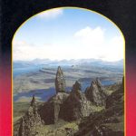 Trotternish – Skye Harvey Superwalker XT25
 Jura Harvey Superwalker XT25
 Ochil Hills Harvey Superwalker XT25
 Cairn Gorm & Ben Avon Harvey Superwalker XT25
 Peak District Central Harvey Superwalker XT25
 The Cuillin – Skye Harvey Superwalker XT25
Yorkshire Dales North East Harvey Superwalker XT25
The Cuillin – Skye Harvey Superwalker XT25
Yorkshire Dales North East Harvey Superwalker XT25
 Ben Nevis – Mamores & Grey Corries Harvey Superwalker XT25
Yorkshire Dales North West Harvey Superwalker XT25
Dartmoor North Harvey Superwalker XT25
Ben Nevis – Mamores & Grey Corries Harvey Superwalker XT25
Yorkshire Dales North West Harvey Superwalker XT25
Dartmoor North Harvey Superwalker XT25
 Dartmoor South Harvey Superwalker XT25
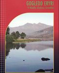 Snowdonia North Harvey Superwalker XT25
 Rum – Eigg – Canna – Muck Harvey Superwalker XT25
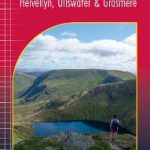 Lake District East – Helvellyn – Ullswater & Grasmere Harvey Superwalker XT25
 The Mournes Walks
 Pitlochry – Loch Tummel & Blair Atholl Harvey XT25 Superwalker Map
 Fannichs – Seana Bhraigh & Ben Wyvis Harvey Superwalker XT25
 Crieff & Comrie – Doune – Dunblane Harvey Superwalker XT25
Glen Coe – Glen Etive & Black Mount Harvey Superwalker XT25
Crieff & Comrie – Doune – Dunblane Harvey Superwalker XT25
Glen Coe – Glen Etive & Black Mount Harvey Superwalker XT25
 Arran – incl. Arran Coastal Way Harvey Superwalker XT25 Map
 Loch Lomond & The Trossachs – Ben Lomond & Loch Katrine Harvey Superwalker XT25
 Isle of Man Harvey Superwalker XT30