Disclosure : This site contains affiliate links to products. We may receive a commission for purchases made through these links.
Mountains around Vienna Freytag & Berndt Hiking Atlas
ร–sterreich Wanderatlas (Hiking Atlas of Austria) from Freytag & Berndt in an A5 paperback format, with 200 selected routes shown on extracts from the publisher`s 1:50,000 series, all graded according to the difficulty of the terrain.The atlas presents descriptions of 200 routes, most of them circular tours, grouped by province and indicated on general mapping of the whole country at 1:200,000. Each route is graded according to the difficulty of the terrain and highlighted on an extract from the publishers’ hiking maps at 1:50,000. Each description is accompanied by a route profile. The maps show no geographical coordinates.*PLEASE NOTE BEFORE ORDERING: Map legend and all the text are in German only.*

Related Products:
 Austria Freytag & Berndt Hiking Atlas
 Vienna Woods (Wienerwald) Freytag & Berndt Hiking Atlas
 Salzburg Region Freytag & Berndt Hiking Atlas
 Austria: Freytag & Berndt Hiking Maps
 Germany: Freytag & Berndt Hiking and Leisure Maps
 Via Slavorum (I26 European Pilgrims` Route): Krakรณw ‘“ Rome Freytag & Berndt Map
 Tatra Mountains Panoramic Atlas (PL & SK)
 Austria: Freytag & Berndt Hiking Atlases
 Austria: Freytag & Berndt Cycling Maps
 Val Venosta/Vinschgau Freytag & Berndt Map
 Gesรคuse – Ennstaler Alpen – Schoberpass Freytag & Berndt Map
 Gleinalpe – Lippizanerheimat – Leoben – Voitsberg Freytag & Berndt Map
 Attersee – Mondsee – Wolfgangsee Freytag & Berndt Map
 Merano and Surroundings Freytag & Berndt Map
 Otscherland – Mariazell – Erlauftal – Lunzer See – Scheibbs Freytag & Berndt Map
 Saualpe – Lavanttal – Koralpe – Region Schlicherheimat Freytag & Berndt Map
 Mallorca Hiking Atlas Kompass 2753
 Bohemian Forest – Mรผhlviertel – Moldau/Vltava Reservoir Freytag & Berndt Map
 Thayatal National Park – Znaim – Retz – Gars am Karp Freytag & Berndt Map
 Grossglockner – Heiligenbult – Sonnblick – Shobergruppe – Oberes Mรถlltal Freytag & Berndt Map
 Rรผgen Freytag & Berndt Map
 Austria – Bavavia – South Tyrol Freytag & Berndt Ski-Atlas
 Montenegro Wilderness Biking Atlas
 Muntanyes Mร giques / Magical Mountains Hiking Trail
 Inn Bike Trail: Landeck – Passau Freytag & Berndt Map
 Kamp – Thaya – March Bike Trail Freytag & Berndt Map
 Tauern Bike Trail: Krimml – Passau Freytag & Berndt Map
 Austria: Freytag & Berndt 200K Road Maps
 Vienna – 1 City in 3 Days Freytag & Berndt Travel Guide
 Austria Freytag & Berndt Biking Atlas
 Camino de Santiago – The Way of St James Michelin Zoom Pocket Road Atlas 160
 Croatia: Freytag & Berndt 200K Regional Road Maps
 Fagaras Mountains Dimap Hiking Map
 Parang Mountains Dimap Hiking Map
 Austria F&B Motorcycle Road Atlas
 Sweden: Freytag & Berndt Regional Road Maps
 Gilau Mountains Dimap Hiking Map
 Italy: Freytag & Berndt “Top 10 Tips” Road Maps
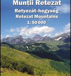 Retezat Mountains Dimap Hiking Map
 Germany: Freytag & Berndt “Top 10 Tips” Road Maps