Disclosure : This site contains affiliate links to products. We may receive a commission for purchases made through these links.
Mount Olympos Region – Eastern Lycia

Mount Olympos in the eastern Lycia region of Turkey on a detailed, contoured, GPS compatible map at 1:54,000 from EWP showing the course of the Lycian Way, with a list of useful addresses including accommodation, etc.The map uses as its base the old Soviet military survey, adapted by the publishers to reflect current information. Contours are at 40m intervals. The course of the waymarked Lycian Way is indicated and other local paths are shown including mountain routes to peak of Mt Olympos. Other information includes rock climbing sites, archaeological remains, locations of petrol stations, bus stations, etc. Latitude and longitude lines are drawn at 2’ intervals. Map legend is in English, Turkish and German. On the reverse are English language notes about the Lycian Way, useful contact details including accommodation, places to eat, etc, plus numerous colour photos.

Related Products:
 Central Lycia – Kas and neighbouring Areas
 Western Lycia – Fethiye to Kalkan
 Mount Pelion – Mount Mavrovouni Anavasi 4.3/4.4
 Lycia – Beydaglar to Finike Topographical Tourist Map
 Poppy Poppy & Pollo go to Mount Olympos!
 Mount Kenya Map & Guide
 Lycia East Hiking 2-Map Set
 Eastern Crete Terrain Editions 450
 Lycia West Hiking 2-Map Set
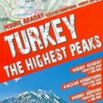 Turkey`s Highest Peaks – Mount Ararat – Kackar Mountains – Mount Suphan terraQuest Trekking Map
 Bachimala – Valles de Chistau y Bielsa Editorial Alpina
Cotiella ‘“ Peรฑa Montaรฑesa Editorial Alpina
Bachimala – Valles de Chistau y Bielsa Editorial Alpina
Cotiella ‘“ Peรฑa Montaรฑesa Editorial Alpina
 Eastern Rhodope Mountains
 Lasithi – Eastern Crete Anavasi 92
 Alto Sil
 Thrace and Eastern Macedonia Terrain Editions Regional Map 1
 Puigmal – Vall de Nuria – Ulldeter Editorial Alpina
 Eastern Rhodopes / Rodopi Geopsis 131
 Sierra de Guadarrama
 Catllarร s – Picancel Editorial Alpina
 Santorini Reise Know-How
 Zambia Reise Know-How
 Belize & Eastern Guatemala ITMB
Zambia & Eastern Africa ITMB Road Map
Belize & Eastern Guatemala ITMB
Zambia & Eastern Africa ITMB Road Map
 El Turbรณn ‘“ Alto Valle de Isรกbena Editorial Alpina
 Vall de Lord – Port del Comte Editorial Alpina
 Val d`Aran – Mauberme – Montardo – Molieres Editorial Alpina
 Montgrony – Fonts del Llogregat – Parc Natural del Cadรญ-Moixerรฒ Editorial Alpina
 Garraf – la Morella – Eramprunya Editorial Alpina
Val d`Aran by UTMB Editorial Alpina Trail running race Map
Garraf – la Morella – Eramprunya Editorial Alpina
Val d`Aran by UTMB Editorial Alpina Trail running race Map
 Turkish Riviera – Antalya – Kemer – Fethiye F&B Top 10 Tips
 North-Eastern Thailand
 Montseny NP – Turo de l`Home – Les Agudas – Matagalls – la Calma Editorial Alpina 2-Map Set
 Congost de Mont-rebei Editorial Alpina
 Aneto – Maladeta – PN Posets Editorial Alpina
Cerdanya – Alta Cerdanya – Capcir – Andorra Editorial Alpina
Aneto – Maladeta – PN Posets Editorial Alpina
Cerdanya – Alta Cerdanya – Capcir – Andorra Editorial Alpina
 Turkish Riviera – Antalya – Side – Alanya Top 10 Tips
 Valles de Belagua y Roncal Editorial Alpina
 Inn-Salzach-Region – Rupertiwinkel – Eastern Chiemgau UK50-44
 Mount Etna – Alcantara – Simeto