Disclosure : This site contains affiliate links to products. We may receive a commission for purchases made through these links.
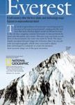
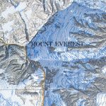
Mount Everest
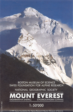
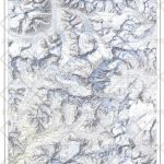
Mount Everest on a visually stunning map published by the Swiss Foundation for Alpine Research, with its reverse side showing the summit area enlarged and overprinted with various ascent routes, plus a history of first ascents by different routes between 1953 and 1990.The map presents an exceptionally clear and detailed picture of the highest part of the Himalayas, with its finely drawn cartography by the Swiss national survey organization providing a 3-D impression of the peaks, ridges and glaciers. The map is based on data drawn from a number of sources, from the earliest explorers’ surveys to imaging taken by the Columbia Shuttle in 1983, and covers an area from Pangboche in Nepal to Rongpudoi Si just north of the main Base Camp on the Tibetan side.Contour lines are drawn at 40m intervals, with numerous spot heights and names of peaks, ridges, glaciers, etc. A variety of shadings and hatchings indicate land type: rock, scree, glacier ice, moraine, etc. and types of vegetation. The map has a 5km UTM grid, plus latitude and longitude margin ticks at 5’ intervals.On the reverse an enlargement shows the summit area in greater detail, including the peaks of Lhotse, Nuptse and Changtse (Bei Peak), overprinted with various ascent routes, all cross-referenced to a history of first ascents by different routes between 1953 and 1990. Each panel with information on a first ascent includes the date, the route taken, names of climbers taking part, and a brief description. Map legend and all the text are in English only. Traditionalist among map collectors will be pleased to see Mount Everest still shown with its old height of 8848m!The main map, without the information provided on the reverse, is also available as a wall map published by the National Geographic Society.

Related Products:
 Mount Everest 50th Anniversary NGS Wall Map
 National Geographic Mount Everest 50th Anniversary Side 1 805 X 526 mm
 National Geographic Mount Everest – Published 1988 575 x 909 mm
 Mount Qomolangma (Sagarmatha/Mount Everest)
 Tibet – Mount Everest – Nam Tso – Lhasa – Shigatse terraQuest Tourist Map
 The Ascent of Everest
 Mount Everest Notebook
 Everest: Jiri to Everest Base Camp
 Tenzing-Hillary Trek – Jiri to Everest Base Camp
 Everest Region Trekking Map
 The Hunt for Mount Everest
 Everest 1953: The Epic Story of the First Ascent
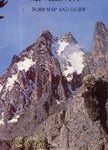 Mount Kenya Map & Guide
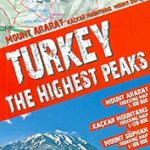 Turkey`s Highest Peaks – Mount Ararat – Kackar Mountains – Mount Suphan terraQuest Trekking Map
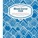 Mount Everest 1938: Whether These Mountains are Climbed or Not, Smaller Expeditions are a Step in the Right Direction
 Everest – Gokyo – Cho La – the Renjo Pass (60K)
 Everest – Summit of the World
 Everest Base Camp & Gokyo – Three Passes 50K
 Dudhkunda- Pikey Cultural Trail & Rejno Pass Trail (Jiri – Pikey – Everest)
 Mount London: Ascents in the Vertical City
 Everest: The West Ridge
 Everest England
 The Conquest of Everest
 Africa`s Highest Peaks – Kilimanjaro – Mount Kenya – Rwenzori terraQuest Trekking Map
 The Boardman Tasker Omnibus: Savage Arena and Everest the Cruel Way; The Shining Mountain and Sacred Summits
 The Fight for Everest 1924: Mallory, Irvine and the Quest for Everest
 Mount Athos
 Coronation Everest
 Mount Elgon
 Mount St Helens – Mount Adams – Gifford-Pinchot National Forest WA
 Solu Khumbu – Everest Region Great Himayala Trail Map
 Mount Gongga Glaciers
 Everest
 Mount Olympos Region – Eastern Lycia
 Everest Base Camp NGS Adventure Map 3001
 Everest – Trekking Map & Complete Guide
 The Third Pole: My Everest climb to find the truth about Mallory and Irvine
 The Crystal Horizon: Everest – The First Solo Ascent
 Banff & Mount Assiniboine Gem Trek
 First Ascent