Disclosure : This site contains affiliate links to products. We may receive a commission for purchases made through these links.
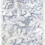
Mount Etna Morphotectonic Map
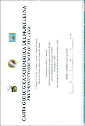
Morphotectonic map of the Mount Etna area at 1:75,000 published by Litografia Artistica Cartografica and prepared by the Geology Department of the University of Catania. Extensive text explaining the use of colours and symbols on the map is in Italian and English. The base map has contours at 50m intervals and shows local towns and villages, including Catania, with the network of connecting roads and tracks. The map also includes a cross-section profile of Mount Etna showing different vents and an inset with a physical map of the area.

Related Products:
 Mount Etna – Alcantara – Simeto
 Mount Etna – Alcantara – Simeto WATERPROOF
 Mount Etna and Taormina TCI Smart Map
 Mount Elgon
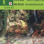 Mount Pelion – Mount Mavrovouni Anavasi 4.3/4.4
 Mount Athos
 Africa`s Highest Peaks – Kilimanjaro – Mount Kenya – Rwenzori terraQuest Trekking Map
 Turkey`s Highest Peaks – Mount Ararat – Kackar Mountains – Mount Suphan terraQuest Trekking Map
 Sicily – 46 Walking Routes Including Mt Etna and the Egadi and Aeolian Islands
 Appalachian Trail: Hanover to Mount Carlo Hiking Atlas, NH/ME
 Appalachian Trail: Mount Carlo to Pleasant Pond Hiking Atlas, ME
 Mount Olympos Region – Eastern Lycia
 Mount Thriptis – Mount Orno – Sitia – Zakros – Vai: 2018
 Mount Qomolangma (Sagarmatha/Mount Everest)
 South Westland: Aoraki/Mount Cook, Lake Tekapo, Twizel
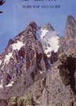 Mount Kenya Map & Guide
 Mount Everest
 Mount St Helens – Mount Adams – Gifford-Pinchot National Forest WA
 National Geographic Mount Everest – Published 1988 575 x 909 mm
 Finland Road Atlas GLOVEBOX, SPIRAL-BOUND
 South Africa F&B
 Tibet – Mount Everest – Nam Tso – Lhasa – Shigatse terraQuest Tourist Map
 The Way of St. James to Compostela: Spanish Section
 Adelaide Hills & Barossa SA
 Sicily F&B Top 10 Tips 2-Map Set
 Mount Xixabangma
 K2 (Mount Qogori)
 Italy F&B
 Aoraki / Mount Cook
 Mount Taranaki
 Belarus Jana Seta Road Map
Austria F&B Great Travel Atlas
Belarus Jana Seta Road Map
Austria F&B Great Travel Atlas
 Central Rhodopes / Rodopi Geopsis 132
 Portugal F&B
 Eastern Rhodopes / Rodopi Geopsis 131
 Mount McKinley
 Western Rhodopes / Rodopi – Falakro Geopsis 133
 Tongariro NP: Mount Ruapehu
 Kilimanjaro: includes Mount Meru & guides to Arusha, Moshi, Marangu, Nairobi & Dar es Salaam