Disclosure : This site contains affiliate links to products. We may receive a commission for purchases made through these links.
Disclosure : This site contains affiliate links to products. We may receive a commission for purchases made through these links.
Categories
-
Best Sellers
-

Benelux: Michelin Regional Road Maps and Atlases
The Benelux countries on indexed regional road maps at 1:200,000 from Michelin with enlargements showing in greater detail road access to principal cities and/or street plans, Read More » -

Red Dog
`In early 1998 I went to Perth in Western Australia in order to attend the literature festival, and part of the arrangement was that I should Read More » -

Follow Me Back
A thrilling read, for fans of Gone Girl and We Were Liars. There was no sign of a struggle, they whisper to each other. She took Read More » -

Grand Canyon National Park West AZ
Grand Canyon West, one of two maps from the National Geographic Society at 1:90,000 approx. providing coverage of the entire Grand Canyon. Printed on light, waterproof Read More » -

Asterix in Britain
Gaul was divided into three parts. No, four parts – for one small village of indomitable Gauls still held out against the Roman invaders. BOOK 8 Read More » -

Le Tour: A History of the Tour de France
Geoffrey Wheatcroft`s hugely entertaining and well researched history of the Tour de France is already established as the definitive account of cycling`s greatest event. Since the Read More » -

Arlon NGI Topo 68/7-8
Topographical survey of Belgium at 1:20,000 from Nationaal Geografisch Instituut / Institut Gรฉographique National, the country’s national survey organization. Each 20K map covers one quarter of Read More » -

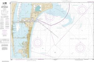
NOAA Chart 11481 – Approaches to Port Canaveral
NOAA maintains the nautical charts and publications for U.S. coasts and the Great Lakes. Over a thousand charts cover 95,000 miles of shoreline and 3.4 million Read More » -

A Day at Versailles
The world`s most iconic chateau has welcomed tourists the world over, yet this handsome slipcased volume offers up the charm of a thousand and one hidden Read More » -

NOAA Chart 19361 – Port Wai’anae’”Island of O’ahu
NOAA maintains the nautical charts and publications for U.S. coasts and the Great Lakes. Over a thousand charts cover 95,000 miles of shoreline and 3.4 million Read More »
-


