Disclosure : This site contains affiliate links to products. We may receive a commission for purchases made through these links.
Montnegre – Corredor Editorial Alpina
The Montnegre – Corredor Natural Park on the Costa Brava presented by Editorial Alpina at 1:25,000 on a contoured and GPS compatible map with an overprint highlighting hiking trails, various accommodation options, etc.Topography is shown by contours at 10m intervals, relief shading and vegetation colouring. In addition to footpaths, the overprint shows various types of accommodation (hotels, youth hostels, campsites, etc), tourist information centres, places of interest, mountain bike routes, locations of petrol station, etc. The map has a 1km UTM grid plus latitude and longitude margin ticks at 1’. Map legend includes English. Accompanying booklet with descriptions of the area and various routes is in Catalan only.To see other titles in the Editorial Alpina series please click on the series link.

Related Products:
 Serra del Cadรญ – Pedraforca Editorial Alpina
 Cingles de Berti – Sant Miquel des Fai Editorial Alpina
Puigsacalm – Bellmunt Editorial Alpina
Cingles de Berti – Sant Miquel des Fai Editorial Alpina
Puigsacalm – Bellmunt Editorial Alpina
 Valles de Irati y Aezkoa Editorial Alpina
 Valles de Belagua y Roncal Editorial Alpina
 Cap de Creus Park Natural Editorial Alpina
 Caps del Nord – Mallorca Editorial Alpina 2-Map Set
 Valles de Ansรณ & Echo Editorial Alpina
Sant Llorenc del Munt i l`Obac Editorial Alpina
Garraf – la Morella – Eramprunya Editorial Alpina
Valles de Ansรณ & Echo Editorial Alpina
Sant Llorenc del Munt i l`Obac Editorial Alpina
Garraf – la Morella – Eramprunya Editorial Alpina
 Montseny NP – Turo de l`Home – Les Agudas – Matagalls – la Calma Editorial Alpina 2-Map Set
 Ibiza – Formentera Editorial Alpina
Ordesa – Monte Perdido National Park Editorial Alpina 2-Map Set
Val d`Aran by UTMB Editorial Alpina Trail running race Map
Ibiza – Formentera Editorial Alpina
Ordesa – Monte Perdido National Park Editorial Alpina 2-Map Set
Val d`Aran by UTMB Editorial Alpina Trail running race Map
 Vall de Lord – Port del Comte Editorial Alpina
 Congost de Mont-rebei Editorial Alpina
Val d`Aran – Mauberme – Montardo – Molieres Editorial Alpina
Congost de Mont-rebei Editorial Alpina
Val d`Aran – Mauberme – Montardo – Molieres Editorial Alpina
 Alt Pirineu Natural Park Editorial Alpina
 Catllarร s – Picancel Editorial Alpina
 Ordesa and Monte Perdido National Park 2-Map Set Editorial Alpina
 Montseny Editorial Alpina
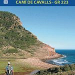 Menorca – Camรญ de Cavalls – GR223 Editorial Alpina CATALAN
 Serra de Tramuntana Editorial Alpina 4-Map Set
 El Turbรณn ‘“ Alto Valle de Isรกbena Editorial Alpina
 Macizo de Monte Perdido – Valle de Ordesa – Pineta Editorial Alpina
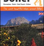 Sรณller – Mallorca Editorial Alpina Map & Guide ENGLISH
 Costabona – Alta Val de Ter Editorial Alpina
 Posets-Maladeta Natural Park 2-Map Set Editorial Alpina
 Mallorca North Walking & Cycling Map & Guide Editorial Alpina
 Montgrony – Fonts del Llogregat – Parc Natural del Cadรญ-Moixerรฒ Editorial Alpina
 Puigmal – Vall de Nuria – Ulldeter Editorial Alpina
Ordesa and Monte Perdido National Park Editorial Alpina
Sierra Nevada – La Alpujarra Editorial Alpina
Puigmal – Vall de Nuria – Ulldeter Editorial Alpina
Ordesa and Monte Perdido National Park Editorial Alpina
Sierra Nevada – La Alpujarra Editorial Alpina
 Taga – Serra Cavallera Editorial Alpina
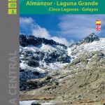 Sierra de Gredos – Almanzor – Laguna Grande Editorial Alpina
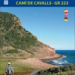 Menorca – Camรญ de Cavalls – GR223 Editorial Alpina ENGLISH
Moixerรณ – La Tosa – Cadรญ-Moixerรณ Natural Park Editorial Alpina
Menorca – Camรญ de Cavalls – GR223 Editorial Alpina ENGLISH
Moixerรณ – La Tosa – Cadรญ-Moixerรณ Natural Park Editorial Alpina
 Valle de Benasque Editorial Alpina
 Picos de Europa National Park 2-Map Set Editorial Alpina
Cerdanya – Alta Cerdanya – Capcir – Andorra Editorial Alpina
Picos de Europa National Park 2-Map Set Editorial Alpina
Cerdanya – Alta Cerdanya – Capcir – Andorra Editorial Alpina