Disclosure : This site contains affiliate links to products. We may receive a commission for purchases made through these links.
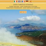
Monti Iblei – South-Eastern Sicily Global Map Tourist Map

Monti Iblei and the south-eastern part of Sicily on a detailed, indexed road map at 1:120,000 from Litografia Artistica Cartografica in the Global Map imprint, highlighting numerous places of interest, with town-by-town lists on the reverse.Coverage includes Ragusa and Siracusa, extending northwards beyond the towns of Lentini and Caltagirone, and westwards along the coast to Gela. Road network indicates local cart tracks and gives distances on main routes. Railway lines are shown with stations. Icons highlight various places of interest including churches and monasteries, important architectural or historical buildings, caves, spas, gardens, etc. The map has no geographical coordinates. Map legend includes English.On the reverse is the map index, plus town-by-town lists of places of interest.


