Disclosure : This site contains affiliate links to products. We may receive a commission for purchases made through these links.
Monte Rosa – Alagna – Macugnaga 50K IGC Map No. 10
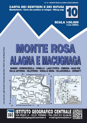
Monte Rosa – Alagna – Macugnaga in a series contoured hiking maps at 1:50,000 with local trails, long-distance footpaths, mountain accommodation, etc. from the Turin based Istituto Geografico Centrale.Maps in this series have contours at 50m intervals, enhanced by shading and graphic relief. An overprint highlights local footpaths and long-distance routes, including the GTA (Grande Traversata delle Alpi), Via Alpina, Tour Monte Rosa, and Alta Via del Monti Liguri – the high level route along the Ligurian Alps. Difficult sections of the routes and the Via Ferrata passages are indicated. New editions now also include an overprint highlighting cycling routes, where indicated in the map’s individual description. The maps also show various types of alpine accommodation: refuges, shelters, hostels, campsites, etc. Cable car lines, chair lifts, and mountain railways are marked, as well as, for road users, entry restrictions on local tracks. Each map covers approximately 50 x 40 km / 30 x 25 miles. The maps have no geographical coordinates. Map legend includes English.To see the other titles in this series please click on the series grid.

Related Products:
 Monte Rosa – Alagna – Valsesia – Macugnaga – Gressoney IGC 109
 Matterhorn / M. Cervino – Monte Rosa IGC 5
 Monte Rosa – Ayas – Gressoney – Alagna L`Escursionista Editore 8
 Valle Anzasca – Monte Rosa – Macugnaga Geo4Map 5
 Monte Rosa – Alagna Valsesia – Rima San Giuseppe – Carcoforo Winter Sports Map
 San Remo – Imperia – Monte Carlo IGC 14
 Cervino – Monte Rosa – Valtourenche – Valle di Champorcher L`Escursionista Editore
 Valsesia – Monte Rosa – Alagna Valsesia – Rima San Giuseppe – Carcoforo Geo4Map 4
 Bardonecchia – Monte Thabor – Sauze d`Oulx 25K IGC Map No. 104
 Monte Lessini – Lessinia Tabacco 059
 Monte Grappa – Basano – Feltre Tabacco 051
 Monte Baldo ‘“ Malcesine ‘“ Garda Tabacco 063
 Monte Rosa Tour
 Monte Bianco/Mt. Blanc – Courmayeur – Chamonix – La Thuile 25K IGC Map No. 107
 Monte Rosa Swisstopo 47
 Alto Garda – Ledro – Monte Baldo North Tabacco 061
 Monte Stivo – Monte Bondone – Rovereto Kompass 687
 Monte Rosa – Valle Anzasca – Valsesia Kompass 88
 Tour del Monte Rosa Map-Guide
 Monte Fumaiolo – Monte Comero 18
 Monte Rosa Freeride Map
 Monviso IGC 6
 Alta Valle del Metauro: Valle del Candigliano, Monte Nerone, Monte Catria
 Lanzo and Moncenisio Valleys IGC 2
 Domodossola – Val Formazza 50K IGC Map No. 11
 Il Cuneese: Cuneo – Saluzzo – Carmagnola 75K IGC Map No. 24
 Genoa – Varazze – Ovada 50K IGC Map No. 16
 Maira, Grana and Stura Valleys IGC 7
 Il Canavese: Ivrea to Chiavasso 50K IGC Map No. 21
 Langhe Meridionali IGC 18
 Asti – Alba – Acqui Terme IGC 19
 Il Monferrato: Asti – Casale Monferrato 50K IGC Map No. 20
 Finale Ligure – Alassio – Savona IGC 15
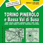 Turin – Pinerolo – Lower Susa Valley 50K IGC Map No. 17
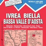 Ivrea – Biela – Lower Aosta Valley 50K IGC Map No. 9
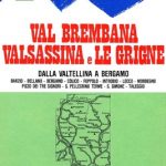 Val Brembana – Valsassina – Le Grigne: Lecco – Bergamo 50K IGC Map No. 22
 Monte Rosa – Alta Valle di Gressoney – Alta Val d’Ayas Fraternali Editore 33
 Monte Baldo North – Bretonico – Malcesine Kompass 691
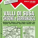 Susa, Chisone & Germanasca Valleys: Sestiere – Sauze d`Oulx – Bardonecia 50K IGC Map No. 1
 Cinque Terre – Golfo del Tigullio: La Spezia – Sestri Levante – Rapallo – Genoa 50K IGC Map No. 23