Disclosure : This site contains affiliate links to products. We may receive a commission for purchases made through these links.
Monte Fumaiolo – Monte Comero 18

Map No. 18, Monte Fumaiolo – Alto Tevere, in series of contoured, GPS compatible hiking maps at 1:25,000 from the Istituto Geografico Adriatico, covering mainly the spine of the Apennines along the borders of Tuscany, Emilia-Romagna, Umbria and the Marches.Map in this series have contours at 25m intervals with additional shading and numerous spot heights. Colouring indicates different types of land use, including woodlands, olive groves, vineyards and orchards. National park and protected areas are marked. An overprint highlights local waymarked hiking routes, indicating their official number or name, including many long-distance routes such GEA (Grande Escursione Appenninica) and the course of the E1 cross-European footpath. Most titles also show cycle routes and/or mountain bike trails. A range of symbols indicate various facilities such as campsites, mountain refuges and other rural accommodation, bars and restaurants, sport and recreational places, historical and cultural monuments, etc. Road network is graded according to width, includes country tracks, and shows sections closed to motorised traffic plus locations of petrol stations. The maps have a 1km UTM, plus latitude and longitude lines at intervals of 5’. Map legend includes English. To see other titles in this series please click on the series link.

Related Products:
 Alta Valle del Metauro: Valle del Candigliano, Monte Nerone, Monte Catria
 Monte Carpegna – Sasso di Simone
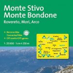 Monte Stivo – Monte Bondone – Rovereto Kompass 687
 Monte Baldo North – Bretonico – Malcesine Kompass 691
Bagno di Romagna Monti Editore 19
Monte Baldo North – Bretonico – Malcesine Kompass 691
Bagno di Romagna Monti Editore 19
 Alpe di San Benedetto 21
Alpe della Luna 17
Alpe di San Benedetto 21
Alpe della Luna 17
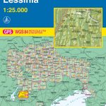 Monte Lessini – Lessinia Tabacco 059
 Monte Baldo ‘“ Malcesine ‘“ Garda Tabacco 063
 Monte Grappa – Basano – Feltre Tabacco 051
 Alto Garda – Ledro – Monte Baldo North Tabacco 061
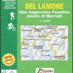 Alta Valle del Lamone 22
Alta Valle del Santerno 23
Alta Valle del Lamone 22
Alta Valle del Santerno 23
 Foreste Casentinesi NP Monti Editore 20
Italy: IGA 25K Hiking Maps of Central Italy
Foreste Casentinesi NP Monti Editore 20
Italy: IGA 25K Hiking Maps of Central Italy
 Ripollรจs Editorial Alpina
Colline di Forlรญ
Alta Val Tiberina
Alta Val Marecchia
Italy: IGA 50K Hiking Maps of Central Italy
Riviera Cesenate – San Marino
Appennino Tosco-Romagnolo East
Colline di Rimini
Ripollรจs Editorial Alpina
Colline di Forlรญ
Alta Val Tiberina
Alta Val Marecchia
Italy: IGA 50K Hiking Maps of Central Italy
Riviera Cesenate – San Marino
Appennino Tosco-Romagnolo East
Colline di Rimini
 Muntanya d’Alinyร Editorial Alpina
 Calblanque, Monte de las Cenizas and Peรฑa del Aguila Regional Park
 Monte Rosa – Alagna – Macugnaga 50K IGC Map No. 10
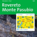 Rovereto – Monte Pasubio Kompass 101
 Valtournenche – Monte Cervino / Matterhorn – Val d`Ayas West L`Escursionista Editore 7
 Monte Bianco / Mt Blanc – Courmayeur L`Escursionista Editore 1
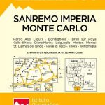 San Remo – Imperia – Monte Carlo IGC 14
 Matterhorn / M. Cervino – Monte Rosa IGC 5
 Monte Baldo – Altipiano di Brentonico – Malcesine Kompass 129
 Monte Rosa – Ayas – Gressoney – Alagna L`Escursionista Editore 8
 Bardonecchia – Monte Thabor – Sauze d`Oulx 25K IGC Map No. 104
 Monte Rosa – Alagna – Valsesia – Macugnaga – Gressoney IGC 109
 Lake Garda – Monte Baldo Kompass 102
 Monte Bianco/Mt. Blanc – Courmayeur – Chamonix – La Thuile 25K IGC Map No. 107
 Arezzo – Casentino – Foreste Casentinesi NP – Monte Falterona Kompass 2459
 Lake Garda – Lake Idro – Monte Baldo – Verona K+F Outdoor Map 7
El Moianรจs
Lake Garda – Lake Idro – Monte Baldo – Verona K+F Outdoor Map 7
El Moianรจs