Disclosure : This site contains affiliate links to products. We may receive a commission for purchases made through these links.
Mont Blanc Massif IGC 4
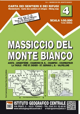
The Mont Blanc Massif in a series contoured hiking maps at 1:50,000 with local trails, long-distance footpaths, mountain accommodation, etc, from the Turin based Istituto Geografico Centrale. The map highlights, among other routes, the Alta Via 1 and the northern section of the Alta Via 2, both of which join up with TMB, as well as the local section of the Via Francigena between Orsiรจres and Aosta. PLEASE NOTE: this title shows all of the Italian section of the Tour of Mont Blanc (TMB) but only the northern part in France and a small section in Switzerland.Maps in this series have contours at 50m intervals, enhanced by shading and graphic relief. An overprint highlights local footpaths and long-distance routes, including the GTA (Grande Traversata delle Alpi), Via Alpina, Tour Monte Rosa, and Alta Via del Monti Liguri – the high level route along the Ligurian Alps. Difficult sections of the routes and the Via Ferrata passages are indicated. New editions now also include an overprint highlighting cycling routes, where indicated in the map’s individual description. The maps also show various types of alpine accommodation: refuges, shelters, hostels, campsites, etc. Cable car lines, chair lifts, and mountain railways are marked, as well as, for road users, entry restrictions on local tracks. Each map covers approximately 50 x 40 km / 30 x 25 miles. The maps have no geographical coordinates. Map legend includes English.To see the other titles in this series please click on the series grid.

Related Products:
 Chamonix-Mont-Blanc – Massif du Mont-Blanc IGN 3630OT
 Annecy – Albertville – Chamonix-Mont-Blanc – Massif du Mont Blanc IGN TOP100 144
 Beaufortain – Massif du Mont Blanc IGN 75004
 Chamonix-Mont-Blanc – Massif du Mont-Blanc IGN WATERPROOF 3630OTR
 Massif du Mont Blanc IGN Wall Map
 Mont Blanc Massif (Vol.I): Selected Climbs
 Mont-Blanc – Annecy Didier Richard 02
 Mont Blanc – Chamnonix – Courmayeur – Grand St-Bernard Swisstopo SKI 292S
 Tour du Mont Blanc L`Escursionista Editore Map-Guide
 Mont Blanc Pocket Map Edition Didier Richard
 Tour du Mont Blanc Editions MPA Panoramic Map
 Mont Blanc Rando Editions
 Tour du Mont-Blanc IGN 89025
 Trekking the Tour of Mont Blanc: Complete two-way hiking guidebook and map booklet
 Tour du Mont Blanc: The most iconic long-distance, circular trail in the Alps with customised itinerary planning for walkers, trekkers, fastpackers and trail runners
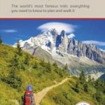 Tour du Mont Blanc: The World`s most famous trek – everything you need to know to plan and walk it
 Saint-Gervais-les-Bains – Massif du Mont Blanc IGN 3531ET
 Saint-Gervais-les-Bains – Massif du Mont Blanc IGN WATERPROOF 3531ETR
 Mont Blanc Kompass 85
 Du Lรฉman ร la Vanoise – par le Mont Blanc et le Beaufortain GR5
 Tour du Mont Blanc: including Chamonix, Courmayeur and Argentiere
 Trekking the Giants` Trail: Alta Via 1 Through the Italian Pennine Alps: Beneath Mont Blanc, the Matterhorn and Monte Rosa
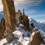 Chamonix – Rockfax: A Guide to the Best Rock Climbs and Mountain Routes Around Chamonix and Mont-Blanc
 Trail Running – Chamonix and the Mont Blanc Region: 40 Routes in the Chamonix Valley, Italy and Switzerland
 Mont Blanc 4810m – 5 Routes to the Summit
 Mont Blanc: Classic & Plaisir
 Tour du Mont Blanc – Easy-to-use Folding Map and Essential Information
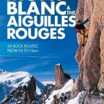 Selected Climbs: Mont Blanc & the Aiguilles Rouges: 60 Rock Routes from F4 to F6a+
 Mountaineering in the Mont Blanc Range: Classic Snow, Ice & Mixed Climbs
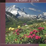 Mont-Blanc – A Walker`s Guide
 Lake Geneva and Mont Blanc IGN 75007
 Mont Blanc – Grand Combin Swisstopo 5003
 Mont Blanc Walks
 Monte Bianco/Mt. Blanc – Courmayeur – Chamonix – La Thuile 25K IGC Map No. 107
 Mont Blanc Supercracks
Tour Pedestre du Pays du Mont Blanc Grp Plus de 10 Jours de Randonnee
Mont Blanc Supercracks
Tour Pedestre du Pays du Mont Blanc Grp Plus de 10 Jours de Randonnee
 Walkers`s Haute Route: Chamonix to Zermatt: The epic journey between Mont Blanc and the Matterhorn
 Mont Blanc: The Finest Routes
Mont Blanc Granite: a rock climbing guide
Mont Blanc: The Finest Routes
Mont Blanc Granite: a rock climbing guide
 Alta Garrotxa – Comanegra – Bassegoda – el Mont Editorial Alpina