Disclosure : This site contains affiliate links to products. We may receive a commission for purchases made through these links.
Milford Track

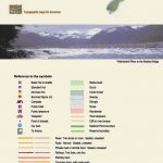
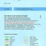
Milford Track in the Fiordland National Park on a light, waterproof and tear-resistant, contoured and GPS compatible map at 1:38,000 in a series from NewTopo NZ Ltd, with exceptionally vivid presentation of the terrain, routes clearly highlighted, and symbols to show locations of various facilities. The map highlights the course of the 53.5-km long Milford Track from Lake Te Anau to the Milford Sound, indicting walking and tramping sections. Contour interval is 20m.Maps in the series from NewTopo NZ Ltd cover the country’s popular hiking and tramping areas. The maps have contours (20m in most titles – please confirm in the individual description) enhanced by relief shading, plus colouring and/or graphics to indicate various types of the terrain and vegetation: glaciers, scree, lava flows, shingle, sand, swamps, exotic forest, scrub, native bush, etc. The overprint for the routes distinguishes, as appropriate, between tramping tracks and routes, walking tracks, and waymarked or unmarked trails. Symbols show facilities such huts, campsites, public toilets, viewpoints, car parks, etc. Where useful, the maps also have brief notes about hut reservations. All the titles are GPS compatible, most with a 1-km NZ national grid (GPS users can uses WGS84).To see all the titles in this series please click on the series link.

Related Products:
 Abel Tasman National Park Coast Track and Inland Track NewTopo Walking Map
 Kepler Track
 Heaphy Track
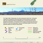
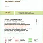
 Tongariro NP: Ruapehu Round the Mountain Track
 Marlborough Sounds: Queen Charlotte Track
 Coromandel Peninsula
 Routeburn, Greenstone and Caples Tracks
 Aoraki / Mount Cook
 Mt Arthur and the Cobb Valley
 Waikaremoana – Te Urewera NewTopo Walking Map
 Aotea / Great Barrier Island
 Tongariro Alpine Crossing
 Arthur`s Pass
 Golden Bay
 Mount Taranaki
 Rakiura / Stewart Island – North West Circuit Rakiura NP
 Lake Taupo
 Rees-Dart Circuit
 Tongariro NP: Mount Ruapehu
 Tongariro Northern Circuit and Tongariro Alpine Crossing
 Cape Reinga Coastal Walkway
 Marlborough Sounds
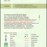
 Fiordland: Milford Sound, Te Anu, Manapouri, Otautau
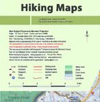
New Zealand: NewTopo Hiking Maps
Fiordland: Milford Sound, Te Anu, Manapouri, Otautau
New Zealand: NewTopo Hiking Maps
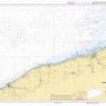
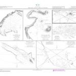
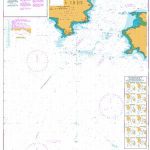
 Admiralty Chart 3275 – Milford Haven Milford Dock to Picton Point
 Y26 Milford Haven
 Cape York – Old Telegraph Track Hema
 Milford Haven: Waterway and Town
 Milford Haven 1906 – 33.14
 Western Australia Hema Road & 4WD Track Atlas A4 SPIRAL-BOUND
 Milford Haven & District 1909 – 226
 Instructional Chart 5136 – Entrance to Milford Haven
 Admiralty Chart 3273 – Entrance to Milford Haven
 Admiralty Chart 2878 – Approaches to Milford Haven
 Utrechtse Heuvelrug
 Northwest Achterhoek
 Southwest Achterhoek
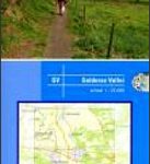 Gelderse Valley
 North Veluwe
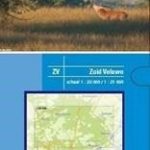 Veluwe South