Disclosure : This site contains affiliate links to products. We may receive a commission for purchases made through these links.
Miedzyrzecz Fortified Region: the Land of Bunkers and Bats
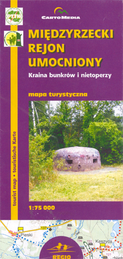
Miedzyrzecz Fortified Region on a detailed recreational map of this fascinating area of western Poland with underground military fortifications build by Germany in the late 1930s and extended in 1945, now part of one of Europe’s largest bat reserves.The map covers an area of approximately 22.5 x 26km (14×17 miles), centred on a town of Miedzyrzecz, surrounded by numerous lakes. This compact area offers varied recreational possibilities: five hiking trails from 12km to 58km long, including part of the European E11 long-distance route; three kayaking routes from 10km to 58km; and seven cycle trails from 10km to 95km.The main attraction of the region are the old German fortifications, including a line of over 40 bunkers and a 35km network of underground tunnels, begun in the summer of 1935 and extended in late 1944. In winter the tunnels provide shelter for over 20,000 bats of 12 different species, one of the largest colonies in Europe. During the remaining seasons part of the fortifications is open to visitors.A wide range of symbols highlight the various trails and fortifications as well as local hotels, campsites and youth hostels; places of interest from old manor houses and churches to fortified bridges and water mills; petrol stations, and much more. *Map legend includes English.* Explanatory text on the reverse is in Polish only.

Related Products:
 Moselle – Trier Region Kompass 834
 Biosphere Region Elbtalaue-Wendland Kompass 862
 Aluksnes Region – Apes Region Jana Seta Map
 Kalkalpen NP – Ennstal – Steyrtal – Pyhrn-Priel-Region Kompass 70
 Underground Cities: Mapping the Tunnels, Transits and Networks of Our Cities
 Anza-Borrego Desert Region, CA
 Berlin – Potsdam Region ADAC Street Atlas
 St. Johann im Pongau – Salzburger Land Kompass 80
 Underground Worlds: A Guide to Spectacular Subterranean Places
NP Kellerwald-Edersee – Habichtswald NP – Medebach Hiking Region Kompass 845
Hamburg – Altes Land Kompass 726
Berchtesgadener Land – Kรถnigssee – NP Berchtesgaden Kompass 794
Nuremberg Land – Hersbrucker Alb Komapss 172
Rheinsberg Lake District – Ruppiner Land Kompass 743
Murnau – Kochel – Blaue Land around Staffelsee Kompass 7
Underground Worlds: A Guide to Spectacular Subterranean Places
NP Kellerwald-Edersee – Habichtswald NP – Medebach Hiking Region Kompass 845
Hamburg – Altes Land Kompass 726
Berchtesgadener Land – Kรถnigssee – NP Berchtesgaden Kompass 794
Nuremberg Land – Hersbrucker Alb Komapss 172
Rheinsberg Lake District – Ruppiner Land Kompass 743
Murnau – Kochel – Blaue Land around Staffelsee Kompass 7
 Osnabrรผcker Land – Bielefeld – Teutoburg Forest – Wiehengebirge Kompass 750
 Berchtesgadener Land – Chiemgau Alps Kompass 14
Ruhr South – Neandertal – Bergisches Land Kompass 756
Southern Teutoburg Forest – Eggegebirge – Oberwรคlder Land Kompass 844
Berchtesgadener Land – Chiemgau Alps Kompass 14
Ruhr South – Neandertal – Bergisches Land Kompass 756
Southern Teutoburg Forest – Eggegebirge – Oberwรคlder Land Kompass 844
 Indian Country – the Four Corners Region AZ/CO/NM/UT
 Klodzko Region (2-map set)
 Inn-Salzach-Region – Rupertiwinkel – Eastern Chiemgau UK50-44
 Niagara Region (Canada) FastTrack Map
 Saualpe – Lavanttal – Koralpe – Region Schlicherheimat Freytag & Berndt Map
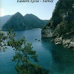 Mount Olympos Region – Eastern Lycia
 Kavango Region Tourist Map
 Klodzko Region 2-Map Set
 Trekking in the Everest Region: Includes Kathmandu City Guide
 Wuppertal – Bergisches Land Supertrail Map
 Jungfrau Region – Brienzersee K+F Hiking Map 31
 Sasso San Gottardo Once and Today Swisstopo Map No. 305
 Busen Region – South Georgia BAS
 Jungfrau Region – Grindelwald K+F Hiking 4
 Wine Trails of Europe
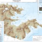 Busen Region – South Georgia BAS Wall Map
 Canberra and Region Hema
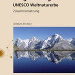 Jungfrau Region – UNESCO World Heritage Site Swisstopo 2520
 Styrian Thermal Region – Southern Burgenland – Styrian Vulkanland F&B WK423
 Four Corners Region Destination Map