Disclosure : This site contains affiliate links to products. We may receive a commission for purchases made through these links.
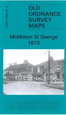
Middleton St George 1913 – 55.12

Related Products:
 Middleton 1891 – 96.08a Coloured Edition
 Middleton (West) Rhodes & Alkrington 1915 – 96.07
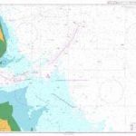
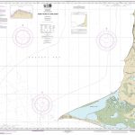
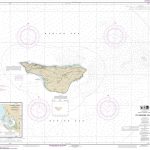 NOAA Chart 16381 – St. George Island – St. George Harbor
 Walking in the Peak District – White Peak East: 42 walks in Derbyshire including Bakewell, Matlock and Stoney Middleton
 George Pig – Keychain
 What George Forgot
 George`s First Day at Playgroup
 George`s Marvellous Medicine
 Peppa Pig: Slow Down, George!
 George and the Unbreakable Code
 Peppa Pig: George`s Balloon
 George`s Dragon Goes Schoo(ne)
 George`s Secret Key to the Universe
 Peppa Pig: George and the Noisy Baby
 Peppa Pig: George Catches a Cold
 St George`s Cross 20 Flag Bunting
Peppa/George Chime and Rattle (assorted)
St George`s Cross 20 Flag Bunting
Peppa/George Chime and Rattle (assorted)
 Roald Dahl: George`s Marvellous Experiments
 Another Great Day at Sea: Life Aboard the USS George H. W. Bush
George Bradshaw Railway Maps Collection
Heanor 1913 – 45.04
Another Great Day at Sea: Life Aboard the USS George H. W. Bush
George Bradshaw Railway Maps Collection
Heanor 1913 – 45.04
 Uxbridge 1913 – 14.03b
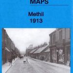 Methil 1913 – 28.08a
 Longbenton 1913 – 31
 Old Thornaby 1913 – 56.04
 Morriston 1913 – 15.09
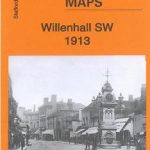 Willenhall SW 1913 – 62.12b
 Walsall (SW) 1913 – 63.10b
 Walsall (SE) 1913 – 63.11b
 Walsall (NW) 1913 – 63.06b
 Bilston 1913 – 62.16c
 Smethwick 1913 – 72.03b
 Bristol (SW) & Bedminster 1913 – 75.04b
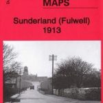 Sunderland (Fulwell) 1913 – 8.06
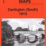 Darlington (South) 1913 – 55.10b
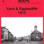 Yarm & Egglescliffe 1913 – 56.11
 Birmingham (East) 1913 – 14.06b
 Lofthousegate & Outwood 1913 – 233.11
 Nottingham (South) 1913 – 42.06c
 Battersea & Fulham 1913 – 100.3