Disclosure : This site contains affiliate links to products. We may receive a commission for purchases made through these links.
Middle Tamar and Caradon 1894
Middle Tamar and Caradon in 1894 in a series of reproductions of Ordnance Survey’s famous “Inch to the Mile” maps published in the Alan Godfrey Editions to provide a historical record of England and Wales in the second half of 19th and early 20th century.Coverage stretches from Smallacoombe Downs and St Clether eastwards to Tavistock and Brent Tor, and from St Stephen and Launceston southwards to St Cleer and Viverdon Down. Other locations include: in CORNWALL Callington, Calstock, Gunnislake, Harrowbarrow, Laneast, Lawhitton, Lewannick, Linkinhorne, North Hill, Pensilva, South Hill, South Petherwin, St Dominick, Stoke Climsland and Trewen; plus in DEVON Bradstone, Coryton, Dunterton, Kelly, Lamerton, Lewtrenchard, Lifton, Marystow, Milton Abbot, North Brentor and Sydenham Dameral. On the reverse is an extract from Cornwall Sheet 30.09 showing Calstock in 1905, with directory extracts.About the Alan Godfrey Editions of the OS Inch to the Mile Maps: the maps provide an invaluable overview of a wider area, typically 18 x 12 miles (29 x 19 kms approx.), and offer historical mapping for small towns and villages not covered by the more detailed series for which the Godfrey Editions are better known. On the reverse all the maps have historical notes and most titles also include a more detailed, large scale map of a small town or a village in the area.To see other titles in this series please click on the series link.

Related Products:
 Plymouth to Polperro 1894
Fareham, Hambledon and Havant 1894
Tunbridge Wells and Ashdown Forest 1894
Lewes and District 1894
Penzance and St Ives Bay 1888
North Dartmoor and Mid-Devon 1887
Chepstow and District 1894
The Cheviot 1901-13 – 5
Isles of Scilly 1896
West Twickenham & Strawberry Hill 1894 – 121a
Montgomery and District 1908
Plymouth to Polperro 1894
Fareham, Hambledon and Havant 1894
Tunbridge Wells and Ashdown Forest 1894
Lewes and District 1894
Penzance and St Ives Bay 1888
North Dartmoor and Mid-Devon 1887
Chepstow and District 1894
The Cheviot 1901-13 – 5
Isles of Scilly 1896
West Twickenham & Strawberry Hill 1894 – 121a
Montgomery and District 1908
 Dunston 1894
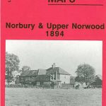 Norbury and Upper Norwood 1894
 Castle Douglas 1894
 Shortlands 1894
 Yeading 1894
North Shields and Chirton 1894
Yeading 1894
North Shields and Chirton 1894
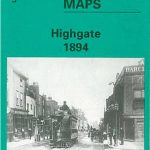 Highgate 1894 – 19.2
Isle of Thanet 1893 – 274
Highgate 1894 – 19.2
Isle of Thanet 1893 – 274
 Creekmouth 1894 – 68.2
Newcastle & Gateshead 1894 – 18a
North Kent Coast 1878
Redesdale 1866
Felling 1894
Creekmouth 1894 – 68.2
Newcastle & Gateshead 1894 – 18a
North Kent Coast 1878
Redesdale 1866
Felling 1894
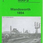 Wandsworth 1894 – 114a
South Dartmoor and the South Hams 1909
Wandsworth 1894 – 114a
South Dartmoor and the South Hams 1909
 Beckenham South 1894
 Southall 1894
Flodden Field & North Cheviots 1901 – 3
South East Essex 1884
North London 1902-13 – 256
Norham & Berwick 1864 – 1
Southampton Water 1884
Ravenglass and Sellafield 1875
Southall 1894
Flodden Field & North Cheviots 1901 – 3
South East Essex 1884
North London 1902-13 – 256
Norham & Berwick 1864 – 1
Southampton Water 1884
Ravenglass and Sellafield 1875
 North Shields & Chirton 1894
 Crystal Palace, Anerley and Upper Norwood 1894 – 145
Dartmoor 1908
Crystal Palace, Anerley and Upper Norwood 1894 – 145
Dartmoor 1908
 Great Britain: Godfrey Editions of Historical Ordnance Survey Inch to a Mile Maps of England & Wales
Hertford and St Albans 1898
Kielder 1866
Great Britain: Godfrey Editions of Historical Ordnance Survey Inch to a Mile Maps of England & Wales
Hertford and St Albans 1898
Kielder 1866