Disclosure : This site contains affiliate links to products. We may receive a commission for purchases made through these links.
Middle East: Maps International Political Wall Map
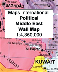
Middle East on a brightly coloured political wall map at 1:4,350,000 from Maps International, size 120 x 100cm (47″ x 39.5″ approx), providing coverage from the western border of Egypt to Delhi and Mumbai, so including the central Asian countries of Uzbekistan, Tajikistan and Kyrgyzstan, plus the whole of Pakistan and Afghanistan. All place names are in the Latin alphabet only: names of countries and of most geographical features are in their English versions, names of capitals and of other large cities are as used in the country itself, so Al Qahira, Dimashq, Ar Riyad, Ad Dawhah, etc, with the English version shown in brackets. Town symbols indicate the size of the population. The map shows the network of main road connections and principal airports. Topography is shown by relief shading with names and heights of selected peaks. Latitude and longitude lines are drawn at 5ยบ intervals. The panel with the map legend includes flags of Middle Eastern countries.

Related Products:
 Europe – Middle East – Central Asia Freytag & Berndt Wall Map
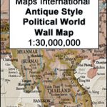 World Maps International Antique Political Wall Map
 Europe – Middle East – Central Asia F&B
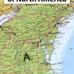 North America: Maps International Political Wall Map PAPER
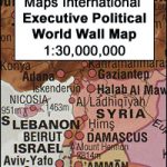 World Maps International Executive Political Wall Map
 Asia Maps International Political Wall Map PAPER
 Europe Maps International Political Wall Map PAPER LARGE
 Europe Maps International Political Wall Map X-LARGE PAPER
 Africa Maps International Political Wall Map PAPER
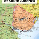 South America: Maps International Political Wall Maps
 South America Maps International Political Wall Map PAPER
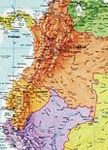
North America: Maps International Political Wall Maps
Asia Maps International Political Wall Map HANGING STRIPS
South America Maps International Political Wall Map PAPER
North America: Maps International Political Wall Maps
Asia Maps International Political Wall Map HANGING STRIPS
 Europe: Maps International Political Wall Map LARGE, HANGING STRIPS
 World Maps International Glow in the Dark Wall Map
 Africa: Maps International Political Wall Map HANGING STRIPS
Asia: Maps International Political Wall Maps
Africa: Maps International Political Wall Map HANGING STRIPS
Asia: Maps International Political Wall Maps
 Australasia: Maps International Political Wall Maps
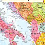 Europe: Maps International Political Wall Maps
North America Maps International Political Wall Map HANGING STRIPS
South America: Maps International Political Wall Map HANGING STRIPS
Africa: Maps International Political Wall Maps
Europe Maps International Political Wall Map LARGE ENCAPSULATED
Europe: Maps International Political Wall Maps
North America Maps International Political Wall Map HANGING STRIPS
South America: Maps International Political Wall Map HANGING STRIPS
Africa: Maps International Political Wall Maps
Europe Maps International Political Wall Map LARGE ENCAPSULATED
 World Maps International Political Wall Map X-LARGE PIN-BOARD FRAMED
 World Maps International Political Wall Map SMALL PIN-BOARD FRAMED with flags
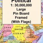 World Maps International Political Wall Map LARGE PIN-BOARD FRAMED with flags
Asia Maps International Political Wall Map ENCAPSULATED
World Maps International Political Wall Map LARGE PIN-BOARD FRAMED with flags
Asia Maps International Political Wall Map ENCAPSULATED
 World Maps International Political Wall Map MEDIUM PIN-BOARD FRAMED with flags
 Europe Maps International Political Wall Map X-LARGE ENCAPSULATED
Africa Maps International Political Wall Map ENCAPSULATED
Europe Maps International Political Wall Map X-LARGE ENCAPSULATED
Africa Maps International Political Wall Map ENCAPSULATED
 World Maps International Political Wall Map X-LARGE PAPER
South America Maps International Political Wall Map ENCAPSULATED
World Maps International Political Wall Map X-LARGE PAPER
South America Maps International Political Wall Map ENCAPSULATED
 World Maps International Political Wall Map X-LARGE MAGNETIC-BOARD FRAMED
 World Maps International Political Wall Map SMALL PAPER
 World Maps International Political Wall Map LARGE MAGNETIC-BOARD FRAMED with flags
 World Maps International Political Wall Map MEDIUM LAMINATED
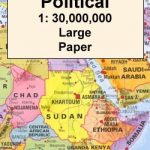 World Maps International Political Wall Map LARGE PAPER
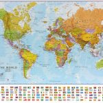
 World Maps International Political Wall Map MEDIUM PAPER
 World Maps International Political Wall Map SMALL ENCAPSULATED
 World Maps International Political Wall Map SMALL MAGNETIC-BOARD FRAMED with flags