Disclosure : This site contains affiliate links to products. We may receive a commission for purchases made through these links.
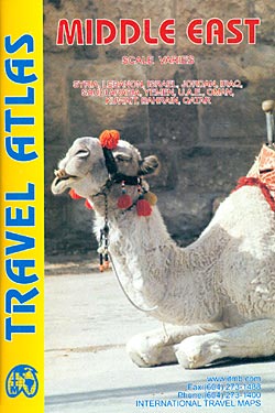
Middle East ITMB Travel Atlas

Mapping by ITMB of Middle East countries presented in a handy size, A5 paperback atlas, with each country accompanied by one or more pages with street plans. The country maps have altitude colouring and spot heights (both given in feet) to show the topography. Additional graphics indicate deserts, swamps, salt pans, etc. Road network includes selected local/desert tracks, gives distances on most main routes, and indicates locations of border crossings. Symbols indicate various places of interest. In most countries the maps show internal administrative boundaries with names of the provinces. Latitude and longitude lines are drawn on the maps. All place names are given in the Latin alphabet only. One combined index covers all the countries.Accompanying street plans highlight various places of interest and facilities, including selected accommodation.The atlas covers:- Bahrain at 1:145,000 with a street plan of central Manama- Iraq at 1:1,500,000 with a street plan of central Bagdad, an enlargement of the city’s environs, plus a small map of the showing ancient cities of Mesopotamia- Israel at 1:280,000 with a street plan of central Jerusalem- Jordan at 1:760,000 with a street plan of central Amman- Kuwait at 1:390,000 with a street plan of central Kuwait City- Lebanon at 1:190,000 with a street plan of central Beirut- Qatar at 1:375,000 with a street plan of central Doha- Saudi Arabia at 1:2,200,000 with a street plan of central Riyadh- Syria at 1:925,000 with a street plan of central Damascus- United Arab Emirates and Oman at 1:1,750,000 with street plans of central Dubai, Muscat and Salalah- Yemen at 1:1,875,000 with street plans of central Sana’a and of Taizz


