Disclosure : This site contains affiliate links to products. We may receive a commission for purchases made through these links.
Mexico Michelin
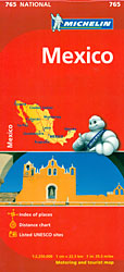
Mexico at 1:2,250,000 from Michelin on an indexed road map, with a street plan of central Mexico City and a more general map of the capital, a distance table, a comprehensive index, plus basic rules for motorists.Coverage extends south-east to include the whole of Guatemala, Belize and San Salvador, with Honduras shown to east of Tegucigalpa including Ceiba. The map covers, therefore, all the Maya archaeological sites of Central America, as well as the remains of the Aztec culture. Coverage in the US includes San Diego, Tucson, and Dallas.Topography is presented by relief shading, with peak heights, names of mountain ranges, colouring for the main forested areas and boundaries of national parks or other protected zones. In coastal waters major coral reefs are also indicatedRoad network is graded into five types, including selected local dirt roads. Driving distances are shown on main and many secondary roads. Railway lines are included and local airports are marked. The map also shows the country administrative boundaries with names of the provinces. Symbols highlight various places of interest, including UNESCO World Heritage sites and other archaeological remains. The map has latitude and longitude lines at intervals of 2ยฐ and a comprehensive index of localities. Map legend includes English.Also provided is a distance table, a list of main motoring regulations, plus two street plans of Mexico City: a more detailed street plan of the city centre highlighting its main sights and places of interest, plus a map of a larger part of the capital including the international airport, the Olympic stadium and Ciudad Universitaria with names of main streets and motorway access.

Related Products:
 Turkey Michelin
 Mexico Nelles
 Mexico ITMB
 Mexico Central & Mexico City ITMB
 Southern Rockies – Arizona – Colorado – New Mexico – Utah Michelin Zoom 175
 Mexico Reise Know-How
 Mexico Road and Tourist Atlas
 Mexico: Ed. Independecia State Road Maps and Street Plans
 Central America – Caribbean Islands – Mexico
 Mexico Pacific & Guadalajara ITMB
 Mexico Pacific Coast & Guadalajara ITMB
 Mexico NGS Adventure Map 3108
 Mexico North-East ITMB
 Crete Michelin
 Mexico Border States: Coahuila, Nuevo Leon, Tamaulipas ITMB
 Mexico Road Map
 Seville Michelin City Map
 Mexico State
 US / Mexico Border ITMB
 Tehran & Northern Iran ITMB
 Made in Mexico: Cookbook: Classic and Contemporary Recipes from Mexico City
 Mexico – Guatemala – Belize – El Salvador Marco Polo Road Map
 Aguascalientes State – Aguascalientes City
 Guanajuato State – Guanajuato City
Durango State – Durango City
Guanajuato State – Guanajuato City
Durango State – Durango City
 Tlaxcala State – Tlaxcala City
Zacatecas State – Zacatecas City
Colima State – Colima City
Tlaxcala State – Tlaxcala City
Zacatecas State – Zacatecas City
Colima State – Colima City
 Campeche State – Campeche City
 Oaxaca State – Oaxaca City
 Veracruz State – Xalpa and Veracruz City
 Querรฉtaro State – Querรฉtaro City
 San Luis Potosรญ State – San Luis Potosรญ City
 Germany Northeast Michelin Regional 542
 Switzerland: Michelin 200K Road Maps
 Iceland Michelin
 North America Michelin Large Format Atlas 2021 – USA – Canada – Mexico
 Germany Mideast Michelin Regional 544
 Mรฉxico State – Toluca
 Michoacรกn State – Morelia