Disclosure : This site contains affiliate links to products. We may receive a commission for purchases made through these links.
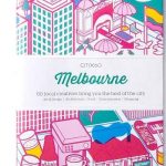
Melbourne Suburbs & City Centre UBD Gregory`s 318
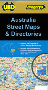
Melbourne Suburbs and City Centre map from UBD Gregory’s combining a building-by-building very detailed street plan of the CBD, a street plan of the city’s central districts, and a more general map of the city with its outer suburbs, plus descriptions of the best sights, selected accommodation, etc. On one side is very detailed street plan at 1:5,000 of the Central Business District, naming numerous buildings, shops and other businesses. Also here is a street plan of the city’s inner districts at 1:10,000, extending south out to the Cricket Ground, Olympic Park and the Goverment House. On both plans access from freeways is clearly laid out, one way streets are marked, and streets are annotated with selected house numbers for easier identification of addresses. The plans have a street index and both indicate various places of interest, cross-referenced to descriptions and/or to the accompanying lists of selected accommodation, theatres and cinemas, and city highlights.On the reverse is a map at 1:120,000 of Melbourne with its outer suburbs. The map shows principal traffic arteries and connecting main streets, highlights national parks and other protected areas, and is indexed for suburbs and localities. Also marked are the area’s main sights, cross-referenced to descriptions and/or a list of suburban highlights, etc.To see a list of other street plans and directories from UBD Gregory`s please click on the series link


