Disclosure : This site contains affiliate links to products. We may receive a commission for purchases made through these links.
Meanwood and Far Headingley 1906
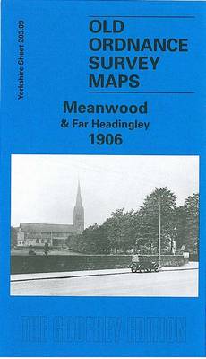
Meanwood and Far Headingley in 1906 in a fascinating series of reproductions of old Ordnance Survey plans in the Alan Godfrey Editions, ideal for anyone interested in the history of their neighbourhood or family. The map covers the Meanwood area on the north side of Leeds. The northern part of Headingley, around St Chad`s church, Otley Road and Moor Road, is in the bottom left corner and coverage extends north to Meanwood Hall, eastward to Carr Manor. The scattered communities across the map include Weetwood, Meanwood, Myrtle Square and Hill Top, Bentley. Features on what was still a semi-rural landscape include Holy Trinity church, Meanwood Tanneries, Weetwood Dye & Print Works, Bardon Hill, Bardon Grange, tramways terminating at Far Headingley and Bentley, Meanwood Quarry. Carr Manor and Meanwood Hall stand in extensive grounds. On the reverse is a good selection of street directory entries for the area.About the Alan Godfrey Editions of the 25″ OS Series:Selected towns in Great Britain and Ireland are covered by maps showing the extent of urban development in the last decades of the 19th and early 20th century. The plans have been taken from the Ordnance Survey mapping and reprinted at about 15 inches to one mile (1:4,340). On the reverse most maps have historical notes and many also include extracts from contemporary directories. Most maps cover about one mile (1.6kms) north/south, one and a half miles (2.4kms) across; adjoining sheets can be combined to provide wider coverage.FOR MORE INFORMATION AND A COMPLETE LIST OF ALL AVAILABLE TITLES PLEASE CLICK ON THE SERIES LINK.

Related Products:
 Hindley Green 1906
 Knotty Ash and Old Swan 1906
Hurst and North Ashton 1906
Knotty Ash and Old Swan 1906
Hurst and North Ashton 1906
 Canterbury 1906 – 46.03
Penryn 1906
Canterbury 1906 – 46.03
Penryn 1906
 Staincliffe and Batley Carr 1892
 Central Leeds 1906 – 218.02b
 Leeds East 1906
Church Stretton and Wenlock Edge 1906
Chigwell Row and Grange Hill 1914
Leeds East 1906
Church Stretton and Wenlock Edge 1906
Chigwell Row and Grange Hill 1914
 Rainhill 1906
Bamfurlong and Bryn Gates 1906
Willenhall North East 1885
Rainhill 1906
Bamfurlong and Bryn Gates 1906
Willenhall North East 1885
 Central Liverpool 1906 – 106.14b
 Walton on the Hill 1906
 Leeds South and South East 1906
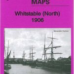 Whitstable (North) 1906 – 23.10
Redruth 1906
Helston 1906
Whitstable (North) 1906 – 23.10
Redruth 1906
Helston 1906
 Bradford Central 1906
 Huddersfield South 1905
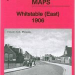 Whitstable East 1906
Darlington North 1896
Whitstable East 1906
Darlington North 1896
 Cambridge (North) 1901 – 40.14
Wolverhampton North West 1901
Cambridge (North) 1901 – 40.14
Wolverhampton North West 1901
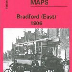 Bradford East 1906
 Stoke upon Trent (South) 1898 – 18.05
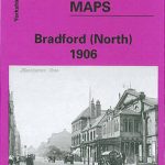 Bradford North 1906
 Handsworth 1913
 Sheffield Longley 1902
 Kirkdale 1906
Tettenhall 1900
Aintree 1906
Kirkdale 1906
Tettenhall 1900
Aintree 1906
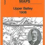 Upper Batley 1906
Newton-le-Willows 1906
Upper Batley 1906
Newton-le-Willows 1906
 St Ives 1906
Tranmere & Oxton 1909
St Ives 1906
Tranmere & Oxton 1909
 Winnipeg – Headingley – Selkirk
North Surbiton and South Kingston 1932
Nottingham North 1913
Winnipeg – Headingley – Selkirk
North Surbiton and South Kingston 1932
Nottingham North 1913