Disclosure : This site contains affiliate links to products. We may receive a commission for purchases made through these links.
Mayotte IGN Map 84976

Mayotte at 1:50,000 on a contoured and GPS compatible map from the IGN, with plans of Mazoudzou and Dzaoudzi, plus an index of beaches. Topography is shown by contours at 20m intervals with relief shading and spot heights, plus colouring and/or graphics for different types of vegetation. In the surrounding waters coral reefs are prominently shown.Road network indicates unsurfaced roads and includes local tracks and paths. An overprint highlights the course of the GR1 ‘“ Tour de Mayotte long-distance footpaths, with symbols marking various facilities and places of interest, including different types of tourist accommodation, local markets, beaches, marinas and water sports sites, golf courses, cultural heritage, etc. The map has a 10km UTM grid, plus latitude and longitude lines at 5’ intervals. Map legend includes English.In addition to an index of beaches, aerial photos with names of main streets and symbols for various facilities cover Mazoudzou and Dzaoudzi.

Related Products:
 SHOM Chart 7493 – Ile de Mayotte – Partie Est – De Dzaoudzi ร la Pointe Saziley
 Admiralty Chart 2757 – Ille de Mayotte – Eastern Part – Dzaoudzi to Pointe Sazile
 Mamoudzou – Mtsamboro – Petite-Terre Mayotte IGN 4410MT
 SHOM Chart 7492 – Ile de Mayotte – Partie Nord – De la Passe des รles Choazil ร Dzaoudzi
 Sada – Mlima Benara – Mlima Choungui – Mayotte IGN 4411MT
 Admiralty Chart 2756 – Ille de Mayotte – Northern Part – Passe des Iles Choazil to Dzaoudzi
 SHOM Chart 7677L – รle de Mayotte – Leisure A4 size
 Mohรฉli IGN Map 85037
 Anjouan IGN Map 85036
 SHOM Chart 7494 – Ile de Mayotte – Partie Ouest – De Chissioua Mbouini ร la Baie d’Acoua
 Martinique IGN 84972
 Madagascar Reise Know-How
 Istria – Kvarner
 St-Barthรฉlemy
 Virgin Islands (US and British) ITMB
 Grande Comore IGN Map 85038
 Iceland Touring Map
 Easter Island / Rapa Nui
 Borneo / Kalimantan ITMB
 Middle Dalmatian Coast 3 – Brac – Hvar – Split F&B
 Carinthia – Northern Adriatic Coast F&B
 Dalmatian Coast 2 – Sibenik – Split – Vis F&B
 Lofoten and Vesteralen Islands
 Madagascar ITMB
 Dalmatian Coast 1 – Zadar – Kornati Islands F&B
 Alta Garrotxa – Comanegra – Bassegoda – el Mont Editorial Alpina
 Reunion IGN 84974
 St. Martin & Anguilla ITMB
 SHOM Chart 7677 – รle de Mayotte
 Saint Martin / Sint Maarten
 Taga – Serra Cavallera Editorial Alpina
 Mali & Mauritania ITMB
 Admiralty Chart 2741 – Ile Mayotte
 Reunion: IGN 25K Topographic Survey Maps
 Cape Peninsula
 Niger IGN 85029
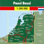 Netherlands F&B
 Martinique & Guadeloupe ITMB
 Germany North F&B
 Saba (Dutch Antilles)