Disclosure : This site contains affiliate links to products. We may receive a commission for purchases made through these links.
Massif du Mont Blanc IGN Wall Map
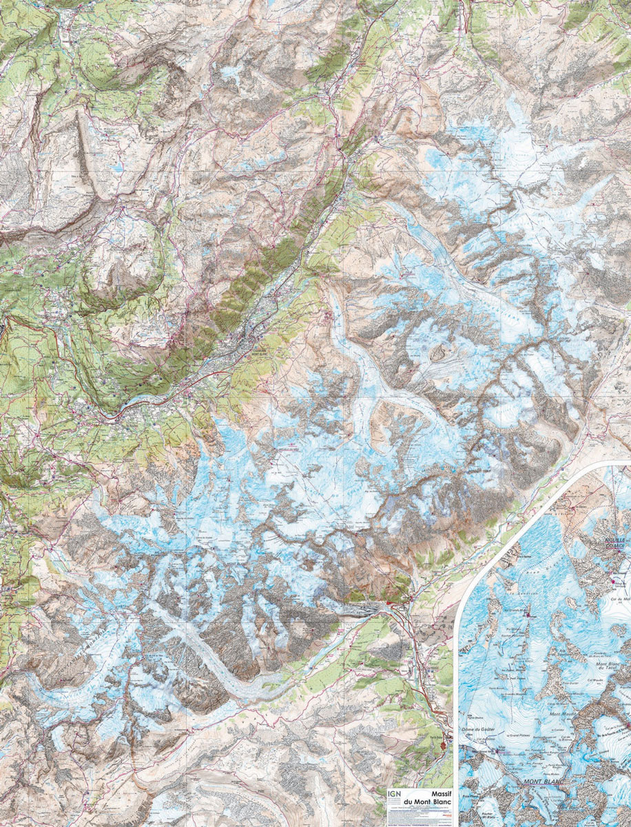
Massif du Mont Blanc presented on an encapsulated waterproof wall map, size 100 x 131cm (39.5″ x 51.5″approx), with cartography of IGN’s excellent TOP25 series reduced slightly to 1:28,000, plus an additional enlargement for the glaciers between the Aiguille du Midi and the peak of Mont Blanc. The map combines sections from the two TOP25 Mont Blanc sheets (3630OT and 3531ET), plus part of the adjoining 3530ET map to provide coverage from Sixt and the FR/CH border crossing north of Vallorcine southwards to the Refuge des Mottets. Coverage includes Chamonix, Argentiรจre, les Houches, etc, and on the Italian side Courmayeur. The base map and the overprint highlighting hiking and ski trails, campsites and refuges, etc, is the same as in the corresponding TOP25 maps. An enlargement shows the glaciers between the Aiguille du Midi and the peak of Mont Blanc with greater clarity. As on the TOP25 maps, the Tour du Mont Blanc (TMB) is marked but not the whole course of it is included in this title.LAMINATED and ENCAPSULATED WALL MAPS:- LAMINATED wall maps have a thin layer of plastic usually applied to the printed side only. They can be written on with suitable marker pens without any damage to the map but, unless laminated on both sides, they are not damp-proof.- ENCAPSULATED wall maps are sealed between two sheets of plastic. They are more rigid and heavier than laminated maps of the same size. They are damp-proof and do not crinkle in humid conditions. Encapsulation gives the map a shiny surface, similar to being displayed behind glass.PLEASE NOTE: many publishers and retailers often use these two terms interchangeably. Our map titles and descriptions follow the definitions provided above.


