Disclosure : This site contains affiliate links to products. We may receive a commission for purchases made through these links.
Massif des Ecrins – Oisans – Champsaur IGN 75006

Ecrins Massif – Oisans – Champsaur region in a series of GPS compatible, contoured TOP 75 maps at 1:75,000 from the IGN, highlighting local and long-distance hiking paths, cycling routes and sites for other recreational activities. The map includes five large panels showing the areas around le Taillfer, le Sirac, Pic du Tourond, le Gragas, and le Lauvitel on IGN’s topographic mapping at 1:25,000 with extensive overprint for local hiking paths and tourist facilities including campsites.Cartography of the main map at 1:75,000 is a direct enlargement of the mapping used in the IGN’s TOP100 series. Contours are at 40m intervals, enhanced by relief shading; additional colouring shows different types of vegetation (woods, brushwood, vineyards/orchards). Boundaries of national parks and other protected areas are marked. An overprint highlights long-distance GR hiking routes and cycling trails. Symbols – more numerous than on the TOP100 maps – indicate various places of interest including mountain refuges and gรฎtes d’etape (campsites on the enlargements), areas for other recreational pursuits such as climbing, hand gliding or water and winter sports, historic or cultural sites, etc. The map has a UTM grid and an index of communes. Map legend includes English.Coverage of the main map starts just north of l’Alpe d’Huez and Col du Galibier (mercifully neither recommended as a cycling route!), extending south to well beyond Gap to include in the south-eastern corner the whole of Lac de Serre-Ponรงon. To see the list of other maps in this series please click on the series link.

Related Products:
 Chaรฎne des Puys – Massif du Sancy IGN 75015
 Vercors Massif IGN 75001
 Pyrรฉnรฉes Catalanes – Font-Romeu – Massif du Canigou IGN 75021
 Chaine des Aravis – Massif des Bauges IGN 75032
 Tour de l`Oisans et des Ecrins – Parc National des Ecrins GR54/GR541
 Massif de la Vanoise IGN 75003
 Beaufortain – Massif du Mont Blanc IGN 75004
 Champsaur – Vieux Chaillol – PN des Ecrins IGN 3437OT
Champsaur – Vieux Chaillol – PN des Ecrins IGN WATERPROOF 3437OTR
Champsaur – Vieux Chaillol – PN des Ecrins IGN 3437OT
Champsaur – Vieux Chaillol – PN des Ecrins IGN WATERPROOF 3437OTR
 Basque Country IGN 75023
 Chartreuse – Belledonne IGN 75002
 Haut-Languedoc IGN 75022
 Cรฉvennes – Gorges du Tarn IGN 75011
 Perigord Noir – Haut-Quercy IGN 75026
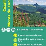 Cรฉzallier – Monts du Cantal IGN 75016
France: IGN 75K/25K TOP75 Recreational Maps
Gavarnie – Neouvielle – Luchonnais – Pic du Midi de Bigorre IGN 75019
Cรฉzallier – Monts du Cantal IGN 75016
France: IGN 75K/25K TOP75 Recreational Maps
Gavarnie – Neouvielle – Luchonnais – Pic du Midi de Bigorre IGN 75019
 Pointe du Raz – Presqu`รฎle de Crozon – Ouessant – les Abers IGN 75024
 Ubaye – Val d`Allos – Lac de Serre-Ponรงon IGN 75008
 Brianรงonnais ‘“ Queyras IGN 75005
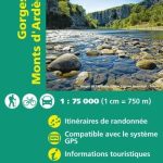 Gorges and Monts d`Ardรจche IGN 75014
 Foret d`Orient – Lac du Der-Chantecoq IGN 75039
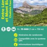 Lake Geneva and Mont Blanc IGN 75007
 Golfe du Morbihan – Belle-รle et Groix – Presqu`รle de Quiberon IGN 75017
 Diois – Dรฉvoluy – Haute Vallรฉe de la Drรดme IGN 75009
 Pyrรฉnรฉes Ariรฉgeoises – Mont Valier – Pique d`Estats IGN 75020
 Provence – Ste-Victoire – Ste-Baume – Calanques IGN 75035
 รle de Rรฉ – รle d`Olรฉron – Marais Poitevin IGN 75038
Baie de Somme – Cote d`Albatre – Fecamp – Etretat IGN 75036
รle de Rรฉ – รle d`Olรฉron – Marais Poitevin IGN 75038
Baie de Somme – Cote d`Albatre – Fecamp – Etretat IGN 75036
 Saint Malo – Cรดte d`Emeraude – Le Mont-Saint-Michel IGN 75037
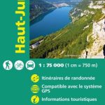 Haut-Jura IGN 75012
 El Moncayo Editorial Piolet
 Ecrins Rando Editions
 Kurhessisches Bergland
 Verdon – Lac de Sainte-Croix – Plateau de Valensole IGN 75013
 Ecrins Massif Wall Map
 Mont Blanc Massif IGC 4
 รcrins Massif National Park Didier Richard 05
 Massif des Bauges
 Mountaineering in the Ecrins Massif: Classic Snow, Rock & Mixed Climbs