Disclosure : This site contains affiliate links to products. We may receive a commission for purchases made through these links.
Martinique IGN 84972
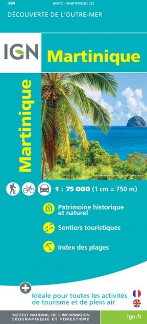
Martinique at 1:75,000 on a map from the IGN, the national mapping agency of France, with highlighting for places of interest and hiking trails, presentation of topography through contours and relief shading, etc, plus aerial photographic plans of Fort-de-France and St-Pierre. Detailed classification of the road network includes country tracks and local paths. Driving distances are marked on main and secondary routes, and scenic roads are highlighted. Also marked are waymarked walking trails. A wide range of symbols indicate various places of interest including beaches and water sports sites, other recreational facilities, cultural heritage, different types of tourist accommodation including campsites, etc. Topography is presented by contours enhancde by relief shading, with colouring and/or graphics for different types of terrain and vegetation (rain forests, mangroves, plantations, etc). Also marked are internal administrative boundaries and towns are annotated with population figures. The map has both UTM and latitude/longitude grids for GPS. The index lists the beaches marked on the map. Map legend includes English.Arial photos of Fort-de-France and St-Pierre highlight various places of interest in both towns.The map also shows coverage of Martinique by the topographic survey of the island at 1:25,000: the three maps at that scale, all available from Stanfords, also highlight trails and places of interest.

Related Products:
 Martinique – Fort-de-France – Montagne Pelee – PNR de la Martinique IGN 4501MT
 Martinique & Guadeloupe ITMB
 A30 Martinique
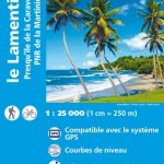 Martinique – Le Lamentin – Presqu`ile de la Caravalle IGN 4502MT
 Martinique – Le Marin – Presqu`ile des Trois Ilets IGN 4503MT
Martinique: IGN 25K Topographic Survey Maps
Martinique – Le Marin – Presqu`ile des Trois Ilets IGN 4503MT
Martinique: IGN 25K Topographic Survey Maps
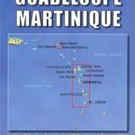 Lesser Antilles: Guadeloupe and Martinique
 Martinique Michelin Zoom 138
 Grenada, Carriacou and Petite Martinique Bradt Guide
 B Martinique to Trinidad
 Saint Lucia & Martinique ITMB
 Martinique to Trinidad
 Martinique Islands Flag – 1/2 yard – Printed
 SHOM Chart 6738 – La Martinique – Partie Sud
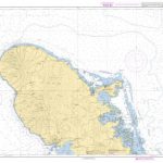
 SHOM Chart 7041 – La Martinique – Partie Nord
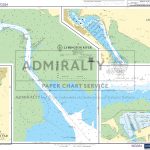
 Admiralty Chart 596 – Southern Martinique to Saint Vincent
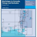 B5 Martinique to Grenada, Tobago and Barbados Passage Chart
 SHOM Chart 6738L – La Martinique – Partie Sud – Leisure A4 size
 Cape Peninsula
 SHOM Chart 7041L – La Martinique – Partie Nord – Leisure A4 size
 Caribbean Islands East & South ITMB Travel Atlas
 Posada
 Ile d`Olรฉron – Ile de Rรฉ Rando Editions
Isola di San Pietro
Ile d`Olรฉron – Ile de Rรฉ Rando Editions
Isola di San Pietro
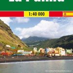
 La Palma F&B Pocket Map
 La Palma F&B
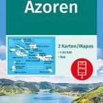 Azores 2-Map Set Kompass 2260
 Tenerife Kompass 233
 Gulf of Orosei
Gulf of Oristano
Gulf of Orosei
Gulf of Oristano
 Georgia Geoland Road Map WATERPROOF
 Saba (Dutch Antilles)
 Urzulei
Santa Margherita to Calasetta
Bay of Porto Conte to Platamona
Capo San Lorenzo to Capitana
Urzulei
Santa Margherita to Calasetta
Bay of Porto Conte to Platamona
Capo San Lorenzo to Capitana
 Gran Canaria Kompass 237
 Latgale South Jana Seta Tourist Map
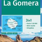 La Gomera Kompass 231