Disclosure : This site contains affiliate links to products. We may receive a commission for purchases made through these links.
Maritime cards


Related Products:
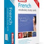 Berlitz Vocabulary Study Cards French (Language Flash Cards)
 Berlitz Vocabulary Study Cards Spanish (Language Flash Cards)
 SAR Convention: International Maritime Convention on Maritime Search and Rescue, 2006 Edition
 ITU Manual For Use By The Maritime Mobile and Maritime Mobile-Satelite Services 2016 – CD only
 IMO Maritime Safety
 Maritime & Coastguard Agency (MCA) Publications
 House of Cards
 Cards on the Table
 Flip Cards
We Three Kings Xmas cards
Flip Cards
We Three Kings Xmas cards
 Waddingtons No 1 Playing Cards
 The Wild Cards: A 100 Postcard Box Set
 Usborne Activity Cards
 Great Outdoors Playing Cards
 Berlitz German Flash Cards
 Berlitz French Flash Cards
 The Art Game: Artists` Trump Cards
 M. C. Escher Playing Cards Double Deck
 Berlitz Language: Spanish Flash Cards
 London Winter Christmas Cards by Coconut Tin
 World Travel Greeting Cards by Coconut Tin
 Body Language Decoder: 50 Cards To Reveal What They`re Really Thinking
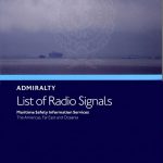 NP283(2) Maritime Safety Information Services. The Americas, Far East and Oceania, Volume 3(2) 2nd Edition (2021).
 Stars: A Practical Guide to the Key Constellations – Contains 20 Unique Pin-hole Cards
 The National Trust: Colouring Book of Cards and Envelopes: Nature
 Millie Marotta`s Tropical Wonderland Postcard Box: 50 Beautiful Cards for Colouring in
 Millie Marotta`s Tropical Wonderland Postcard Book: 30 Beautiful Cards for Colouring in
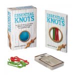 Essential Knots Kit: Includes Instructional Book, 48 Knot Tying Flash Cards and 2 Practice Ropes
 Favourite Poems of the Sea: Poems to Celebrate Britain`s Maritime Heritage
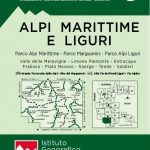 Maritime and Ligurian Alps IGC 8
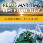 Reeds Maritime Meteorology
 England`s Maritime Heritage from the Air
 Maritime Training on Board
 La Charente-Maritime ร pied
 Maritime Piracy Incidents World Map
 Reeds Maritime Flag Handbook
 The Sea and Civilization: A Maritime History of the World
 Hull: Yorkshire`s Maritime City
Canada Maritime Provinces c.1900
Hull: Yorkshire`s Maritime City
Canada Maritime Provinces c.1900
 Chart D – Maritime Boundaries of Denmark