Disclosure : This site contains affiliate links to products. We may receive a commission for purchases made through these links.
Marismas del Odiel Natural Park CNIG Map
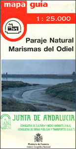
Marismas del Odiel Natural Park on the coast of western Andalucรญa around Huelva on a large, contoured and GPS compatible map at 1:25,000 from IGN/CNIG using cartography of their civilian topographic survey of Spain. Boundaries of various reserves in this area of wetlands popular with bird watchers are prominently marked. Contours are 10m intervals, with coloring/graphics to show different types of vegetation. The map shows the network of local roads, country tracks and footpaths but without special overprint for waymarked routes. Symbols mark local landmarks. The map has a 1km UTM grid and margin ticks for latitude and longitude at 1’ intervals. Map legend is in Spanish only. To see other titles in this series please click on the series link.

Related Products:
 Urbasa and Andรญa Natural Park CNIG Map
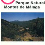 Montes de Mรกlaga Natural Park CNIG Map
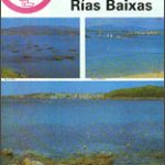 Rรญas Baixas CNIG Map
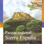 Sierra de Espuรฑa Natural Park CNIG Map
 Cap de Creus Park Natural Editorial Alpina
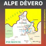 Alpe Dรจvero Natural Park 30K Zanetti Map No. 55
 Alt Pirineu Natural Park Editorial Alpina
 L`Albera Natural Park
 Cap de Creus Natural Park
 Caรฑรณn del Rรญo Lobos Natural Park
 Cabo de Gata-Nรญjar Natural Park Editorial Alpina
 Figueres – Aiguamolls dels Empordร Natural Park
Els Ports Natural Park: Vall-de-roures – Arnes
Cadรญ-Moixerรณ Natural Park West: la Seu d’Urgell – Vall de la Vansa
Figueres – Aiguamolls dels Empordร Natural Park
Els Ports Natural Park: Vall-de-roures – Arnes
Cadรญ-Moixerรณ Natural Park West: la Seu d’Urgell – Vall de la Vansa
 Moixerรณ – La Tosa – Cadรญ-Moixerรณ Natural Park Editorial Alpina
 Sierra de Marรญa-Los Vรฉlez Natural Park Editorial Piolet
 Bavarian Forest National Park – Nature Park East UK50-29
 Serra d`Irta Natural Park – Columbretes Islands
 Abel Tasman National Park Coast Track and Inland Track NewTopo Walking Map
 Bay of Cadiz Natural Park CNIG Map
 Alt Pirineu Natural Park NE: Pica d’Estats – Vall de Cardos – Vall Ferrera
 Serranรญa de Cuenca Natural Park CNIG Map
Sierra Norte Natural Park CNIG Map
Fichtelgebirge Nature Park East – Steinwald Nature Park
Serranรญa de Cuenca Natural Park CNIG Map
Sierra Norte Natural Park CNIG Map
Fichtelgebirge Nature Park East – Steinwald Nature Park
 Islas de Cรญes Natural Park CNIG Map
 Cabo de Gata-Nรญjar Natural Park CNIG Map
Sierra de Ancares Natural Park CNIG Map
Cabo de Gata-Nรญjar Natural Park CNIG Map
Sierra de Ancares Natural Park CNIG Map
 Hassberge Nature Park UK50-02
 Posets-Maladeta Natural Park 2-Map Set Editorial Alpina
Cadรญ-Moixerรณ Natural Park East: el Moixerรณ – Tรบnel del Cadรญ
Posets-Maladeta Natural Park 2-Map Set Editorial Alpina
Cadรญ-Moixerรณ Natural Park East: el Moixerรณ – Tรบnel del Cadรญ
 Bavarian Rhon Nature Park UK50-01
Franconian Forest Regional Park UK50-04
Bavarian Rhon Nature Park UK50-01
Franconian Forest Regional Park UK50-04
 Fichtelgebirge Regional Park West
 Cavalls del Vent – Cadi-Moixero Natural Park Hiking Circuit Editorial Alpina
Lindau – Nature Park Nagelfluhkette UK50-45
Cavalls del Vent – Cadi-Moixero Natural Park Hiking Circuit Editorial Alpina
Lindau – Nature Park Nagelfluhkette UK50-45
 Maritime Alps Natural Park – Entracque – Valdieri – Mercantour – Gelas IGC 113
Bavarian Forest Nature Park South
Maritime Alps Natural Park – Entracque – Valdieri – Mercantour – Gelas IGC 113
Bavarian Forest Nature Park South
 Steigerwald Naturel Park Northern Section – Bamberg UK50-08
 Altmรผhl Valley Regional Park: central part
 Bavarian Forest Regional Park: western part