Disclosure : This site contains affiliate links to products. We may receive a commission for purchases made through these links.
Categories
-
Best Sellers
-

Lonely Planet Pocket Jerusalem & Tel Aviv
Lonely Planet: The world`s number one travel guide publisher*Lonely Planet`s Pocket Jerusalem && Tel Aviv is your passport to the most relevant, up-to-date advice on what Read More » -

NP87 Volume P: South China and E Archipelagic Seas Edition 2021
NEW EDITION OUT 19/09/2019ADMIRALTY Lists of Lights and Fog Signals provides coverage of over 85,000 light structures including lighthouses, lightships, lit floating marks, fog signals and Read More » -
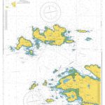
Admiralty Chart 2707 – Kingstown Bay to Cleggan Bay and Inishobofin to Inishturk
Admiralty standard nautical charts comply with Safety of Life at Sea (SOLAS) regulations and are ideal for professional, commercial and recreational use. Charts within the series Read More » -

London: A-Z Wall Maps of London in 1964
Reproductions of A-Zโ€s wall maps covering London on four sheets, originally published in 1964 ahead of major road infrastructure development to meet the demands of increasing Read More » -

Walking Caithness and Sutherland
-

Republic Of Ireland (Eire) Hand Flag
100% polyester, screen printed Rep of Ireland flag on a 30cm wooden pole with a white plastic ball cap Read More » -

Maine Easy to Fold Rand McNally
Maine on a laminated and waterproof Easy-to-Fold map from Rand McNally, the country’s leading publisher of road maps and street plans. For clarity of road information Read More » -

CHS Chart 4012 – Yarmouth to Halifax
The official Canadian charts provide an excellent range of scales for the whole length of Canada`s coastline as well as the Grat Lakes and comply with Read More » -

Kilimanjaro & Tanzania North ITMB
Kilimanjaro on a GPS compatible map at 1:62,500 from ITMB, showing main trekking and climbing routes, with on the reverse an indexed road map of Northern Read More » -

Stanford`s Library Map of London Sheet 16 Black and White (1862) – A3 Wall Map, Paper
-


