Disclosure : This site contains affiliate links to products. We may receive a commission for purchases made through these links.
Categories
-
Best Sellers
-

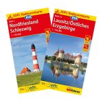
Saarland – Moselle Cycling Map 19
Saarland – Moselle: Koblenz – Trier – Kaiserslautern area of western Germany in a series of waterproof and tear-resistant, GPS compatible cycling maps at 1:150,000 from Read More » -

Immersion suit with text (2019)
Photoluminescent Vinyl – 150mm x 150mm.Stanfords is an official distributor of Maritime Progress safety signs. We are able to source a full range of their products Read More » -

Discovering Glasgow Collins Illustrated Map
Glasgow, the largest city in Scotland, is on the itinerary of many visitors to the country. This updated map displays delightful watercolour mapping, with individual paintings Read More » -
Southern England – Wales Reise Know-How
Southern England and Wales on an indexed, double-sided map at 1:400,000 from Reise Know-How printed on light, waterproof and tear-resistant synthetic paper. The map, published as Read More » -

Felix CNIG Topographic Map 1044-IV
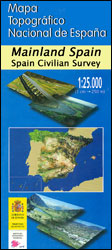
Topographic coverage of mainland Spain at 1:25,000 published by the Centro Nacional de Informaciรณn Geograficรก, the country’s civilian survey organization. The maps have contours at 10m Read More » -

Hiroshige & Eisen: The Sixty Nine Stations of the Kisokaido
A historic trail through the heart of Japan, by two legendary woodblock artists The Kisokaido route through Japan was ordained in the early 1600s by the Read More » -

Yorkshire Dales South West Harvey Superwalker XT25
The south-western part of the Yorkshire Dales at 1:25,000 on a light, waterproof and tear-resistant map from Harvey Map Services in their Superwalker series. Coverage extends Read More » -

A Naturalist`s Guide to the Trees of Southeast Asia
A photographic identification guide to 286 native and introduced species of tree, shrub and palm most commonly seen in Southeast Asia. High quality images from the Read More » -

Montevideo
Montevideo in a series of light, laminated and waterproof concertina street plans of Latin American capitals, designed to present each city’s most visited areas. The plans Read More » -

Canada F&B
Large, double-sided, indexed map of Canada, extending northwards to show the whole of the Northwest Passage. Relief shading shows the country’s topography, with plenty of names Read More »
-


