Disclosure : This site contains affiliate links to products. We may receive a commission for purchases made through these links.
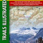
Manning Park – Skagit River ITMB
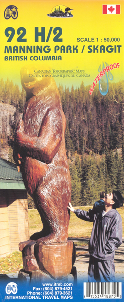
Manning Park – Skagit River at 1:50,000 in a series of topographic survey maps of selected areas of British Columbia and the Canadian Rockies from ITMB with cartography from Canada’s national survey organization. Most sheets are printed on light, waterproof and tear- resistant plastic paper.Whilst the Canadian Department of Natural Resources (previously Canada Map Office) decides whether to provide updated pre-printed editions of its survey mapping or switch to print-on-demand only, in 2007 it began co-operating with ITMB on this new series of maps with cartography of the Canadian topographic survey and additional tourist and recreational information provided by ITMB. The maps are double-sided, with either two 1:50,000 maps combined in one title, or a 1:250,000 map supplemented by more detailed coverage at 1:50,000. *In this title:* contours at 100 feet intervals, with a UTM grid and margin ticks for latitude and longitude. Overprint highlights Trans-Canada trail and other paths, as well as various areas and facilities for horse riding, skiing, canoeing and climbing. Also indicated are accommodation facilities, shelters, RV sites and campsites, and wilderness camps. The map is printed on light, waterproof and tear-resistant plastic paper.

Related Products:
 Tweedsmuir Provincial Park ITMB
Revelstoke National Park ITMB
Tweedsmuir Provincial Park ITMB
Revelstoke National Park ITMB
 Garibaldi Provincial Park ITMB
Strathcona Plateau – Buttle Lake ITMB
Garibaldi Provincial Park ITMB
Strathcona Plateau – Buttle Lake ITMB
 Bowron Lakes Canoe Route ITMB
Gulf Islands – Nanaimo and Islands ITMB
Bowron Lakes Canoe Route ITMB
Gulf Islands – Nanaimo and Islands ITMB
 Canadian Rockies – Banff – Kootenay – Yoho Parks ITMB
North Vancouver – Port Coquitlam ITMB
Canada: ITMB/Canada Map Office Topographic Maps of British Columbia and the Rockies
Wells Gray – Murtle Lake ITMB
Canadian Rockies – Banff – Kootenay – Yoho Parks ITMB
North Vancouver – Port Coquitlam ITMB
Canada: ITMB/Canada Map Office Topographic Maps of British Columbia and the Rockies
Wells Gray – Murtle Lake ITMB
 West Coast Trail & Carmanah Valley ITMB
Lower Mainland – Richmond & New Westminster ITMB
West Coast Trail & Carmanah Valley ITMB
Lower Mainland – Richmond & New Westminster ITMB
 Algonquin Park ITMB
 Canada: ITMB Detailed Road Maps of British Columbia and the Canadian Rockies
 New River Gorge National River WV
 USA: Regional Coverage by ITMB Maps
 Lassen Volcanic National Park, CA
 Chugach State Park – Anchorage AK
 Elevenmile Canyon – South Park CO
 Saguaro National Park AZ
 Big Bend National Park TX
 Zion National Park UT
 Yosemite National Park CA
 Redwood National Park CA
 Arches National Park UT
 Acadia National Park ME
 Shenandoah National Park VA
 Glacier Bay National Park AK
 Olympic National Park WA
 Haleakala National Park HI
 Badlands National Park SD
 Everglades National Park FL
 Voyageurs National Park MN
 Yellowstone National Park WY/MT
 France ITMB
 Old Faithful – Yellowstone National Park SW WY/MT
 Virgin Islands National Park
 Lassen Volcanic National Park CA
 Mammoth Cave National Park KY
 North Cascades National Park WA