Disclosure : This site contains affiliate links to products. We may receive a commission for purchases made through these links.
Manchester A-Z Street Atlas
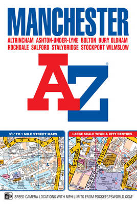
This A-Z map of Manchester includes coverage of:Manchester, Altrincham, Ashton-under-Lyne, Bolton, Bury, Oldham, Rochdale, Salford, StockportThe paperback book includes 162 pages of continuous street mapping extending to include coverage of:Cheadle, Heywood, Hyde, Irlam, Manchester Airport, Poynton, Prestwich, Radcliffe, Ramsbottom, Stalybridge, Swinton, Urmston, WilmslowThere are also large scale city and town centre maps of Manchester, Altrincham, Ashton-under-Lyne, Bolton, Bury, Oldham, Rochdale and Stockport and a postcode map.Postcode districts, one-way streets, safety camera locations with speed limits and National Park boundaries are also featured on the mapping.The index section lists streets; selected flats, walkways and places of interest; place and area names; National Rail and Metrolink stations. There is a separate list of hospitals, hospices and NHS Walk-in Centres covered by the atlas.An easy to follow map of the Manchester Metrolink is featured on the back cover.

Related Products:
 Greater Manchester A-Z Street Atlas
 Manchester A-Z Big Street Atlas SPIRAL-BOUND
 Manchester Premier A-Z Map
 Manchester Premier A-Z Map WATERPROOF
 Merseyside A-Z Street Atlas
 Manchester A-Z Pocket Street Map
 Manchester Premier A-Z Wall Map
 Liverpool A-Z Street Atlas
 Birmingham A-Z Street Atlas
 Norwich A-Z Street Atlas
 Bolton – Bury A-Z Street Atlas
 Bournemouth A-Z Street Atlas
 Newcastle upon Tyne A-Z Street Atlas
 Southampton – Eastleigh – Fawley – Hythe – Romsey A-Z Street Atlas
 Coventry – Rugby A-Z Street Atlas
 Manchester and District 1896
 Ipswich – Felixstowe A-Z Street Atlas
 Nottingham – Ilkeston – Long Eaton – West Bridgford A-Z Street Atlas
 Manchester Then and Now: A Photographic Guide to Manchester Past and Present
 Cardiff A-Z Street Atlas
 Southampton A-Z Street Atlas
 Manchester & Salford – Oldham, Rochdale & Stockport OS Explorer Map 277 (paper)
 Portsmouth A-Z Street Atlas
 Manchester & Salford – Oldham, Rochdale & Stockport OS Explorer Active Map 277 (waterproof)
 Brighton and Worthing A-Z Street Atlas
 Nottingham A-Z Street Atlas
 London A-Z Big Street Atlas
Manchester Oxford Street and Gaythorn 1849
London A-Z Big Street Atlas
Manchester Oxford Street and Gaythorn 1849
 Edinburgh A-Z Street Atlas
Canterbury – Margate – Ramsgate A-Z Street Atlas
Edinburgh A-Z Street Atlas
Canterbury – Margate – Ramsgate A-Z Street Atlas
 Manchester: Ancoats North 1848
 Zurich Street Atlas
 Manchester PopOut
 Ashton Under Lyne 1933 – 105.06c
 London A-Z Street Atlas
 Greater London A-Z Master Atlas
 Ashton-under-Lyne 1916
 Manchester, Bolton & Warrington OS Landranger Map 109 (paper)
 Taunton A-Z Street Atlas
 Barcelona: Greater Barcenona Telstar Street Atlas